MyTopo
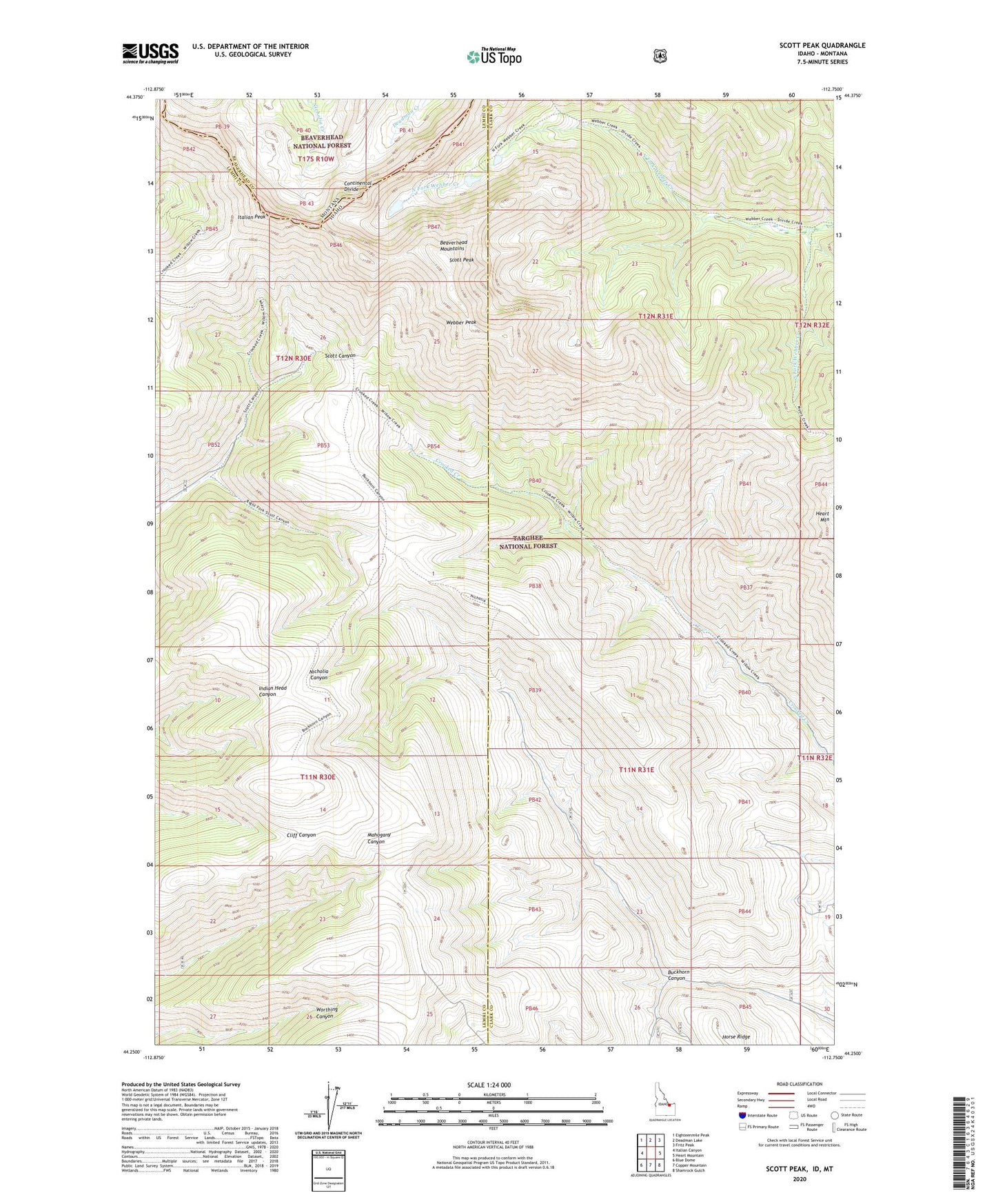
Scott Peak Idaho US Topo Map
Couldn't load pickup availability
Also explore the Scott Peak Forest Service Topo of this same quad for updated USFS data
2023 topographic map quadrangle Scott Peak in the state of Idaho. Scale: 1:24000. Based on the newly updated USGS 7.5' US Topo map series, this map is in the following counties: Lemhi, Clark, Beaverhead. The map contains contour data, water features, and other items you are used to seeing on USGS maps, but also has updated roads and other features. This is the next generation of topographic maps. Printed on high-quality waterproof paper with UV fade-resistant inks.
Quads adjacent to this one:
West: Italian Canyon
Northwest: Eighteenmile Peak
North: Deadman Lake
Northeast: Fritz Peak
East: Heart Mountain
Southeast: Shamrock Gulch
South: Copper Mountain
Southwest: Blue Dome
Contains the following named places: Beaverhead Mountains, Buckhorn Canyon, Italian Peak, North Fork Webber Creek, Scott Peak, South Fork Webber Creek, Webber Peak