MyTopo
Shafer Butte Idaho US Topo Map
Couldn't load pickup availability
Also explore the Shafer Butte Forest Service Topo of this same quad for updated USFS data
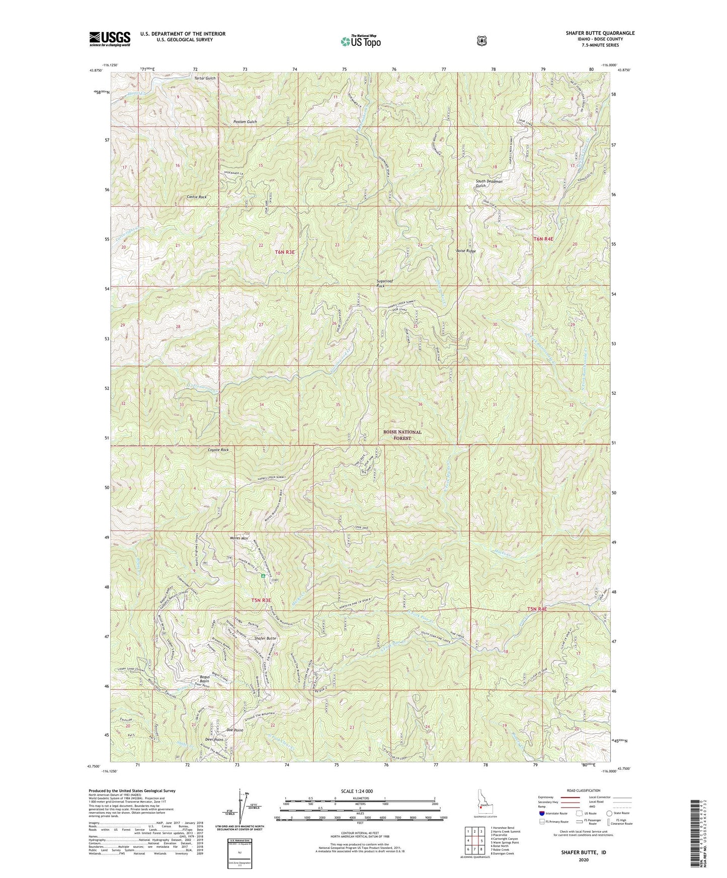
2023 topographic map quadrangle Shafer Butte in the state of Idaho. Scale: 1:24000. Based on the newly updated USGS 7.5' US Topo map series, this map is in the following counties: Boise. The map contains contour data, water features, and other items you are used to seeing on USGS maps, but also has updated roads and other features. This is the next generation of topographic maps. Printed on high-quality waterproof paper with UV fade-resistant inks.
Quads adjacent to this one:
West: Cartwright Canyon
Northwest: Horseshoe Bend
North: Harris Creek Summit
Northeast: Placerville
East: Warm Springs Point
Southeast: Dunnigan Creek
South: Robie Creek
Southwest: Boise North
This map covers the same area as the classic USGS quad with code o43116g1.
Contains the following named places: Bogus Basin, Bogus Basin State Park, Boise Ridge, Bongus Basin Winter Sports Area, Castle Rock, Coyote Rock, Deer Point, Doe Point, KAID-TV (Boise), KBCI-TV (Boise), KBSU-FM (Boise), KBXL-FM (Caldwell), KCIX-FM (Garden City), KFXD-FM (Nampa), KHEZ-FM (Caldwell), KIVI-TV (Nampa), KJHY-FM (Emmett), KJOT-FM (Boise), KLCI-FM (Nampa), KLTB-FM (Boise), KQFC-FM (Boise), KTRV-TV (Nampa), KTSY-FM (Caldwell), KTVB-TV (Boise), KZMG-FM (Boise), KZMG-FM (New Plymouth), Mores Mountain, North Fork Macks Creek, North Fork Pine Creek, Shafer Butte, Shafer Butte Picnic Area, South Fork Pine Creek, Sugarloaf Rock, Tartar Gulch