MyTopo
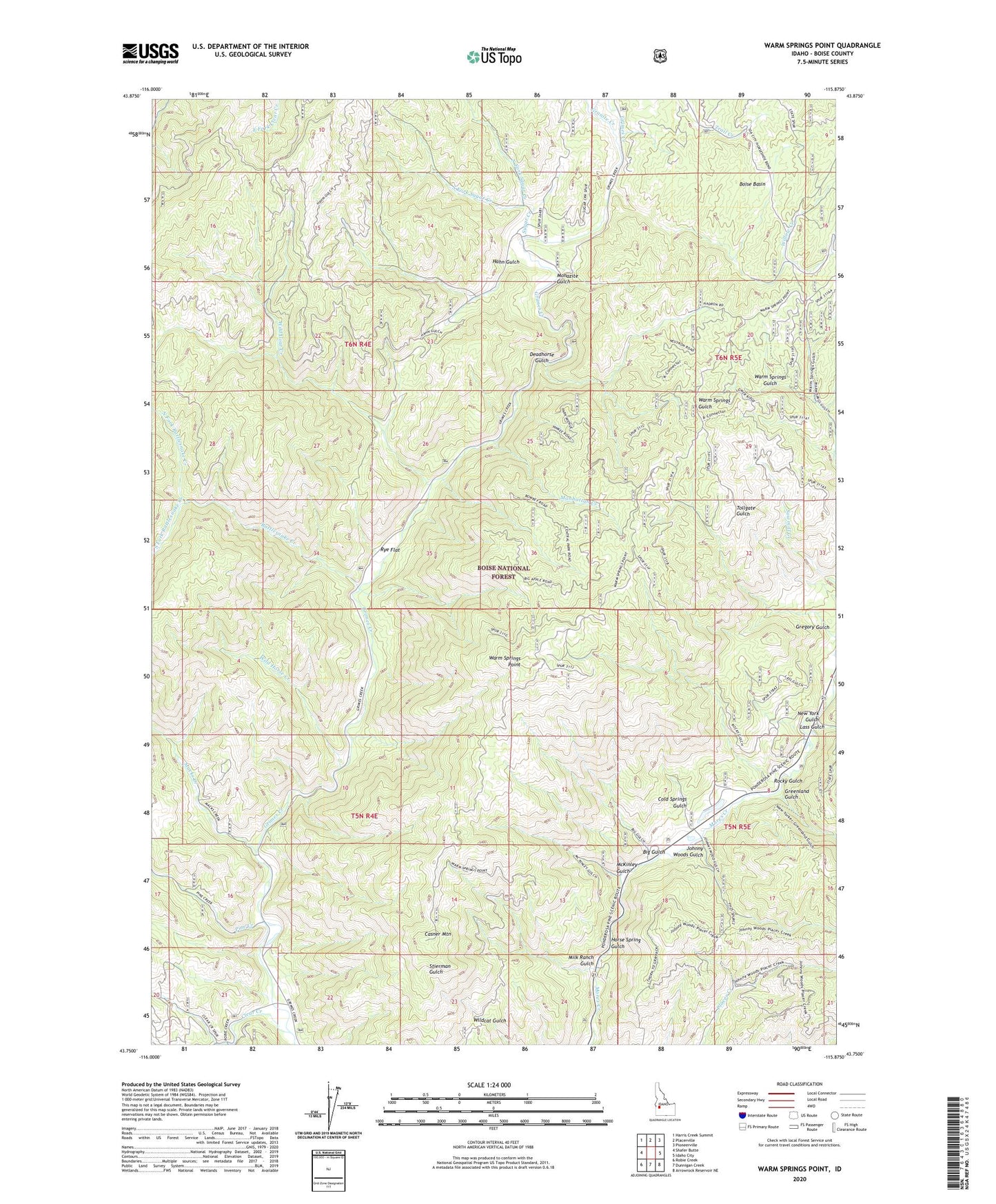
Warm Springs Point Idaho US Topo Map
Couldn't load pickup availability
Also explore the Warm Springs Point Forest Service Topo of this same quad for updated USFS data
2023 topographic map quadrangle Warm Springs Point in the state of Idaho. Scale: 1:24000. Based on the newly updated USGS 7.5' US Topo map series, this map is in the following counties: Boise. The map contains contour data, water features, and other items you are used to seeing on USGS maps, but also has updated roads and other features. This is the next generation of topographic maps. Printed on high-quality waterproof paper with UV fade-resistant inks.
Quads adjacent to this one:
West: Shafer Butte
Northwest: Harris Creek Summit
North: Placerville
Northeast: Pioneerville
East: Idaho City
Southeast: Arrowrock Reservoir NE
South: Dunnigan Creek
Southwest: Robie Creek
This map covers the same area as the classic USGS quad with code o43115g8.
Contains the following named places: Big Gulch, Casner Mountain, Clear Creek, Cold Springs Gulch, Deadhorse Gulch, Granite Creek, Greenland Gulch, Gregory Gulch, Hahn Gulch, Holcomb Guard Station, Horse Spring Gulch, Johnny Woods Gulch, Lass Gulch, Macks Creek, Manhattan Creek, McKinley Gulch, Milk Ranch Gulch, Monazite Gulch, New York Gulch, North Fork Rattlesnake Creek, North Fork Sugar Creek, Pine Creek, Rattlesnake Creek, Rocky Gulch, Rye Flat, South Fork Rattlesnake Creek, South Fork Sugar Creek, Sugar Creek, Valley of the Pines Volunteer Fire Department, Warm Springs Point, Wild Goat Creek, Wild Horse Creek, Willow Creek