MyTopo
Reynolds Idaho US Topo Map
Couldn't load pickup availability
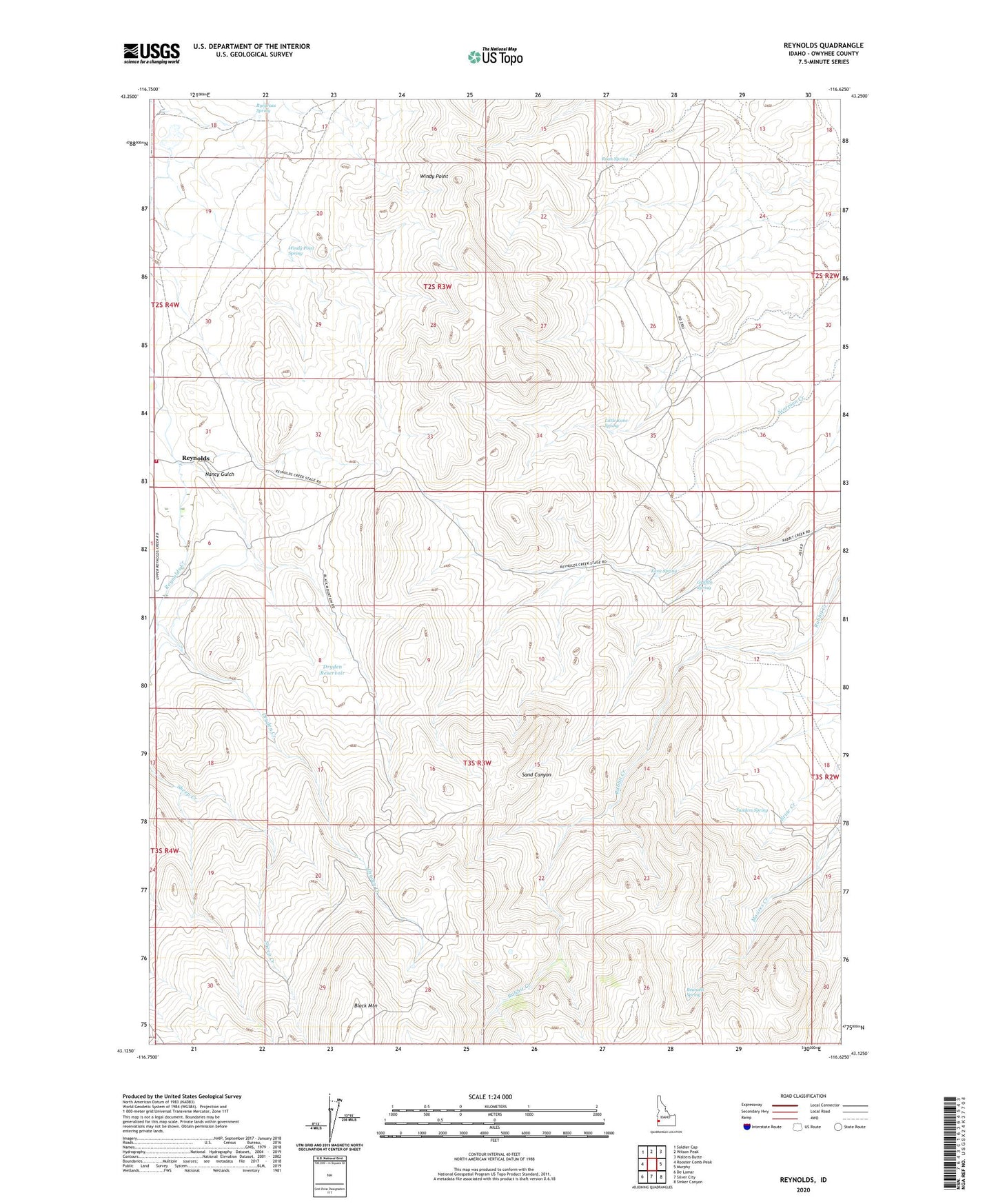
2023 topographic map quadrangle Reynolds in the state of Idaho. Scale: 1:24000. Based on the newly updated USGS 7.5' US Topo map series, this map is in the following counties: Owyhee. The map contains contour data, water features, and other items you are used to seeing on USGS maps, but also has updated roads and other features. This is the next generation of topographic maps. Printed on high-quality waterproof paper with UV fade-resistant inks.
Quads adjacent to this one:
West: Rooster Comb Peak
Northwest: Soldier Cap
North: Wilson Peak
Northeast: Walters Butte
East: Murphy
Southeast: Sinker Canyon
South: Silver City
Southwest: De Lamar
This map covers the same area as the classic USGS quad with code o43116b6.
Contains the following named places: Black Mountain, Brunzell Spring, Dryden Creek, Dryden Reservoir, Griffith Spring, Kane Spring, Little Kane Spring, Nancy Gulch, Reynolds, Reynolds Creek Cemetery, Roan Spring, Ryegrass Spring, Tandem Spring, Tyson Dam, Windy Point, Windy Point Spring