MyTopo
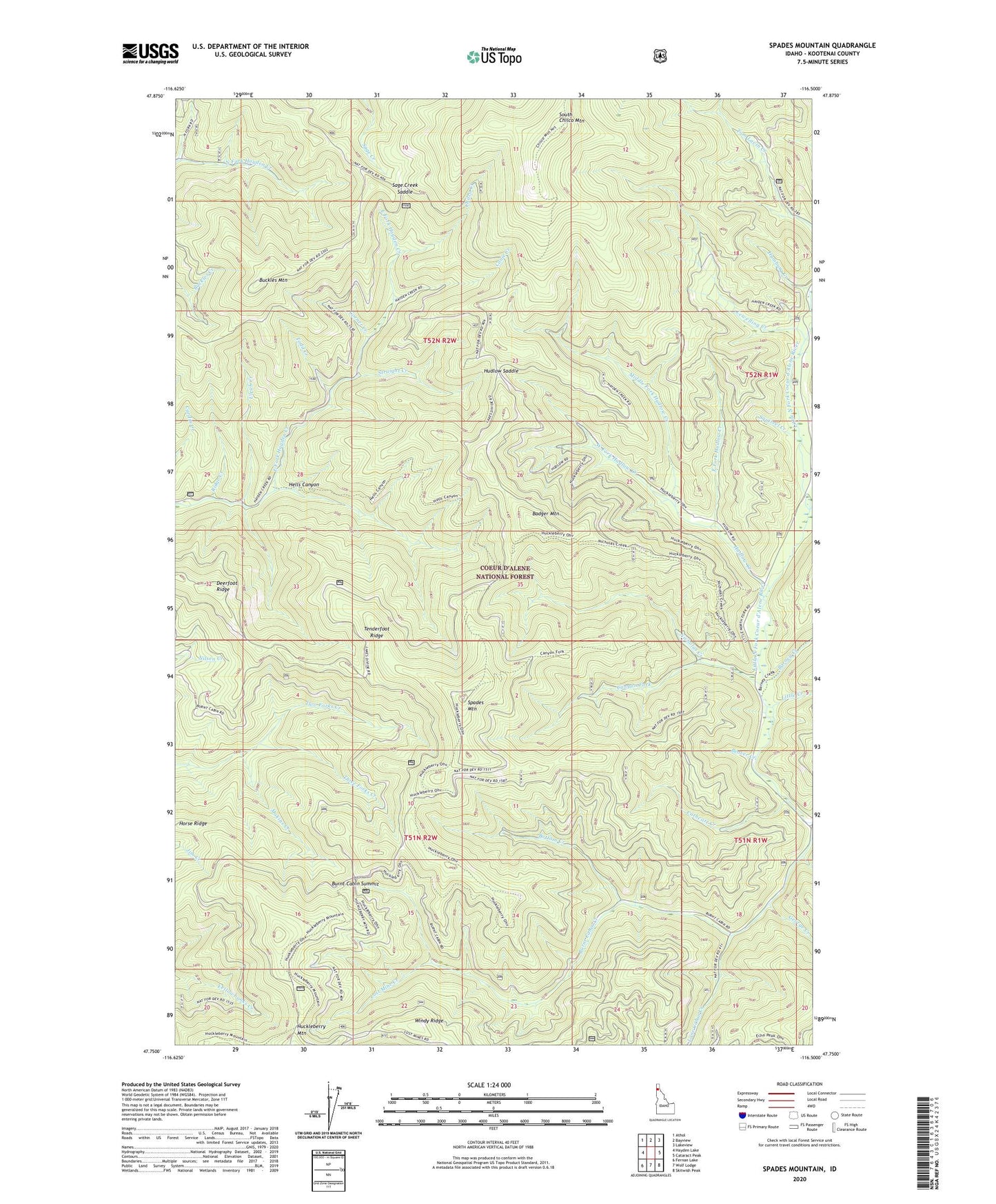
Spades Mountain Idaho US Topo Map
Couldn't load pickup availability
Also explore the Spades Mountain Forest Service Topo of this same quad for updated USFS data
2024 topographic map quadrangle Spades Mountain in the state of Idaho. Scale: 1:24000. Based on the newly updated USGS 7.5' US Topo map series, this map is in the following counties: Kootenai. The map contains contour data, water features, and other items you are used to seeing on USGS maps, but also has updated roads and other features. This is the next generation of topographic maps. Printed on high-quality waterproof paper with UV fade-resistant inks.
Quads adjacent to this one:
West: Hayden Lake
Northwest: Athol
North: Bayview
Northeast: Lakeview
East: Cataract Peak
Southeast: Skitwish Peak
South: Wolf Lodge
Southwest: Fernan Lake
This map covers the same area as the classic USGS quad with code o47116g5.
Contains the following named places: Badger Mountain, Barney Creek, Beaver Creek, Bottom Creek, Bradbury Mine, Buckles Mountain, Burnt Cabin Mine, Burnt Cabin Summit, Canyon Fork, Cathcart Creek, Chilco Creek, Conie Creek, Corner Creek, Dandy Mine, Deerfoot Ridge, East Fork Hudlow Creek, George Creek, Half Mile Creek, Hamburg Creek, Hells Canyon, Horse Ridge, Hudlow Camp, Hudlow Creek, Hudlow Saddle, Iron Creek, Lewelling Creek, Little Creek, Lone Cabin Creek, Lost Mine Creek, Middle Fork Hudlow Creek, Nicholas Creek, Pyrite Creek, Ridge Creek, Sage Creek Saddle, South Chilco Mountain, Spades Mountain, Squirrel Creek, Straight Creek, Tenderfoot Ridge, Three Forks Creek, Todd Creek, Two Forks Creek, Ulrich Creek, West Fork Hudlow Creek