MyTopo
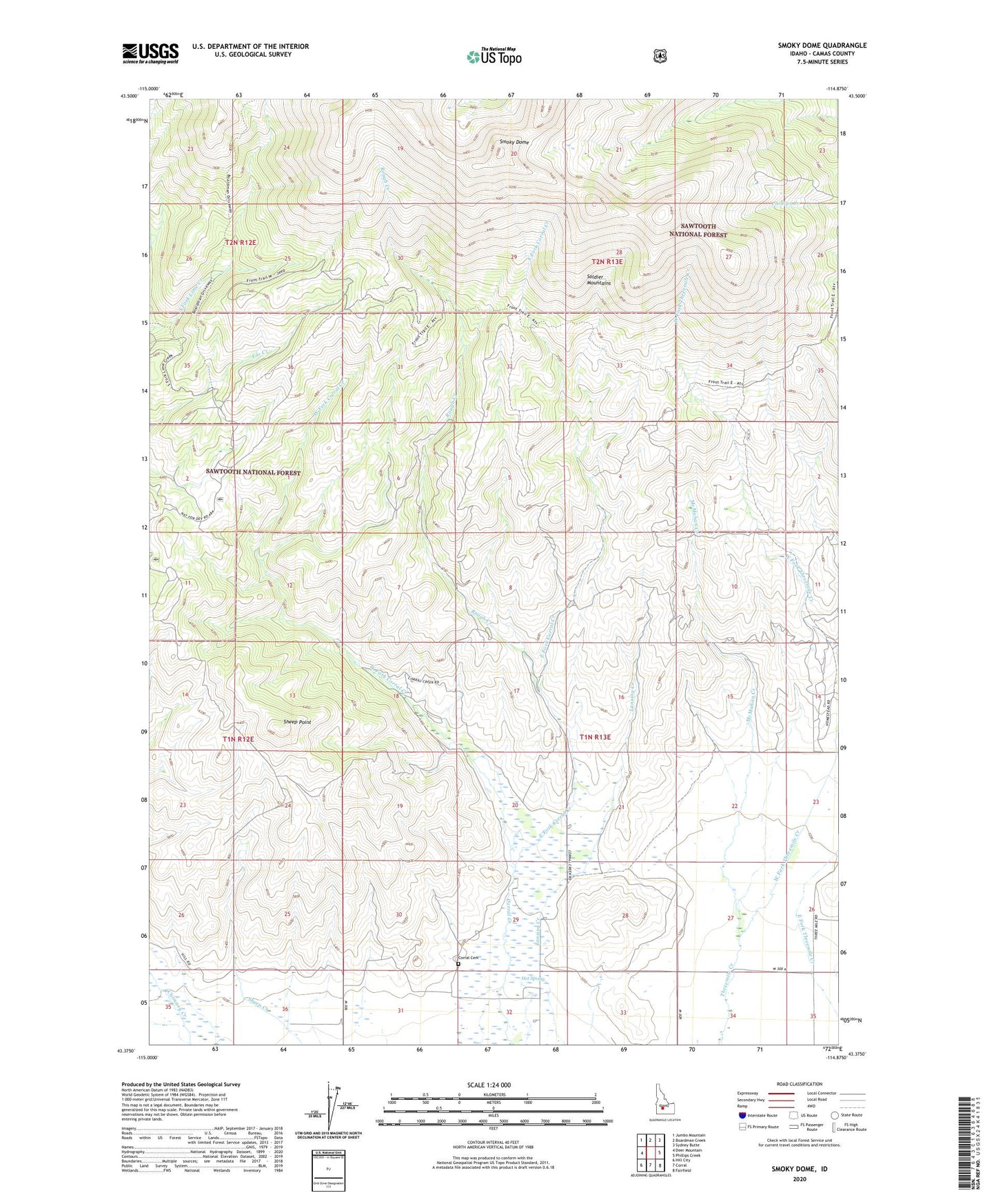
Smoky Dome Idaho US Topo Map
Couldn't load pickup availability
Also explore the Smoky Dome Forest Service Topo of this same quad for updated USFS data
2024 topographic map quadrangle Smoky Dome in the state of Idaho. Scale: 1:24000. Based on the newly updated USGS 7.5' US Topo map series, this map is in the following counties: Camas. The map contains contour data, water features, and other items you are used to seeing on USGS maps, but also has updated roads and other features. This is the next generation of topographic maps. Printed on high-quality waterproof paper with UV fade-resistant inks.
Quads adjacent to this one:
West: Deer Mountain
Northwest: Jumbo Mountain
North: Boardman Creek
Northeast: Sydney Butte
East: Phillips Creek
Southeast: Fairfield
South: Corral
Southwest: Hill City
This map covers the same area as the classic USGS quad with code o43114d8.
Contains the following named places: Corral Cemetery, Ear Creek Sheep Corral, East Fork Corral Creek, Hot Spring, McMahan Creek, Rough Creek, Sheep Point, Smoky Dome, Soldier Mountains, West Camas Division, West Fork Corral Creek, West Fork Threemile Creek