MyTopo
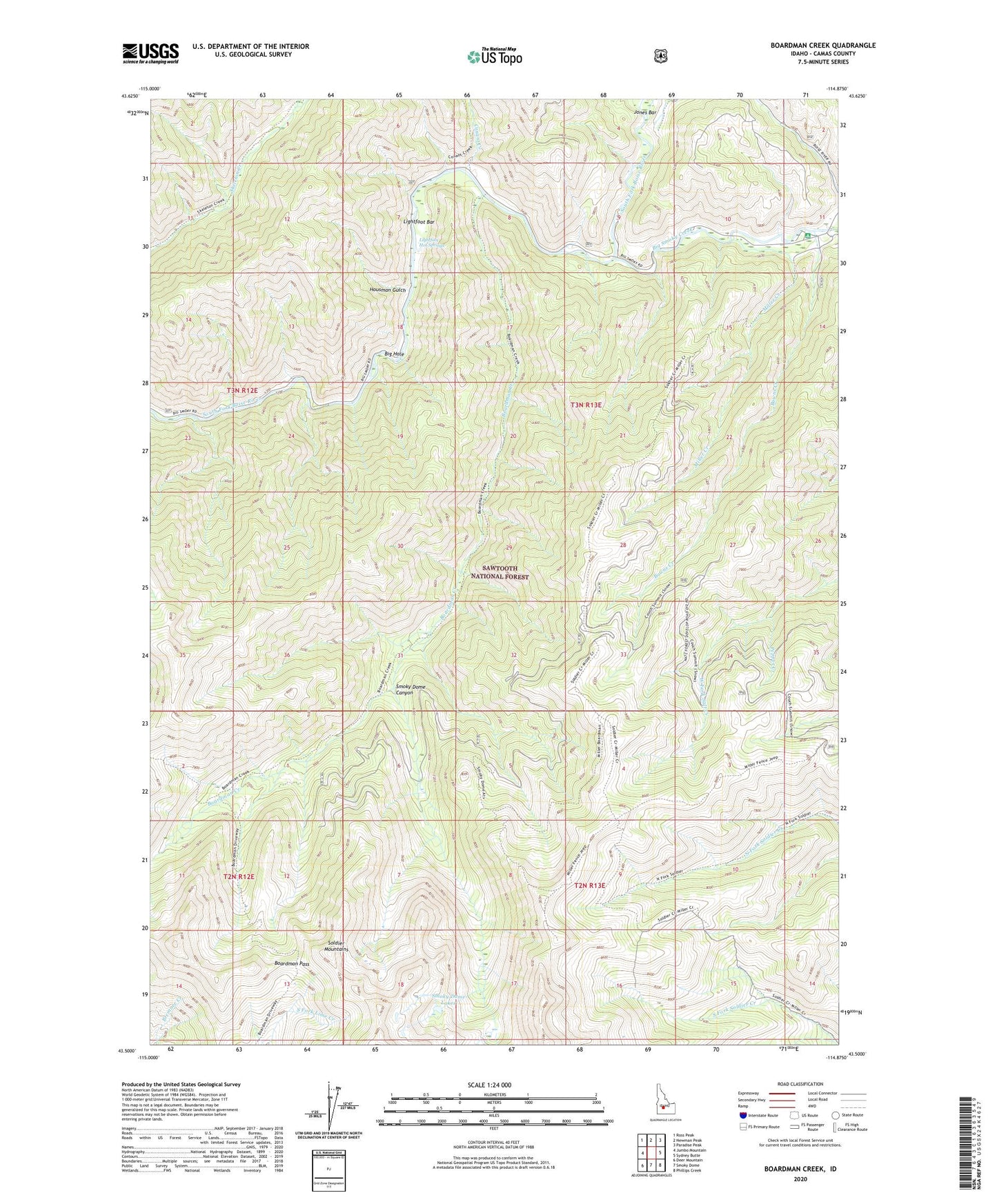
Boardman Creek Idaho US Topo Map
Couldn't load pickup availability
Also explore the Boardman Creek Forest Service Topo of this same quad for updated USFS data
2024 topographic map quadrangle Boardman Creek in the state of Idaho. Scale: 1:24000. Based on the newly updated USGS 7.5' US Topo map series, this map is in the following counties: Camas. The map contains contour data, water features, and other items you are used to seeing on USGS maps, but also has updated roads and other features. This is the next generation of topographic maps. Printed on high-quality waterproof paper with UV fade-resistant inks.
Quads adjacent to this one:
West: Jumbo Mountain
Northwest: Ross Peak
North: Newman Peak
Northeast: Paradise Peak
East: Sydney Butte
Southeast: Phillips Creek
South: Smoky Dome
Southwest: Deer Mountain
This map covers the same area as the classic USGS quad with code o43114e8.
Contains the following named places: Big Hole, Big Smoky Campground, Big Smoky Creek, Boardman Creek, Boardman Pass, Bowns Campground, Bowns Creek, Conant Creek, Housman Gulch, Jones Bar, Lightfoot Bar, Lightfoot Hot Springs, Little Skeleton Creek, Little Smokey Patrol Cabin, Miller Creek, Pepper Creek, River Bend Campground, Smoky Dome Canyon, Smoky Dome Lakes