MyTopo
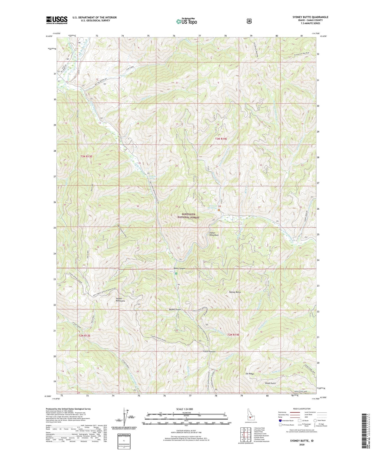
Sydney Butte Idaho US Topo Map
Couldn't load pickup availability
Also explore the Sydney Butte Forest Service Topo of this same quad for updated USFS data
2023 topographic map quadrangle Sydney Butte in the state of Idaho. Scale: 1:24000. Based on the newly updated USGS 7.5' US Topo map series, this map is in the following counties: Camas. The map contains contour data, water features, and other items you are used to seeing on USGS maps, but also has updated roads and other features. This is the next generation of topographic maps. Printed on high-quality waterproof paper with UV fade-resistant inks.
Quads adjacent to this one:
West: Boardman Creek
Northwest: Newman Peak
North: Paradise Peak
Northeast: Baker Peak
East: Dollarhide Mountain
Southeast: Cannonball Mountain
South: Phillips Creek
Southwest: Smoky Dome
This map covers the same area as the classic USGS quad with code o43114e7.
Contains the following named places: Belle Creek, Big Smoky Guard Station, Big Smoky Work Center, Carrie Creek, Carrie Creek Campground, Couch Summit, East Fork Worswick Creek, Elk Ridge, Five Points Campground, Five Points Creek, Five Points Mine, Grindstone Creek, Indian Head Rock, Lick Creek, Little Smoky Campground, Little Smoky Creek, McHan Gulch, Narrows Campground, Paradise Creek, Placer Creek, Preis Hot Spring, Rosetta Creek, Salt Creek, Sydney Butte, Wash Canyon, West Fork Grindstone Creek, West Fork Salt Creek, Williams Creek, Worswick Creek, Worswick Hot Springs