
MyTopo
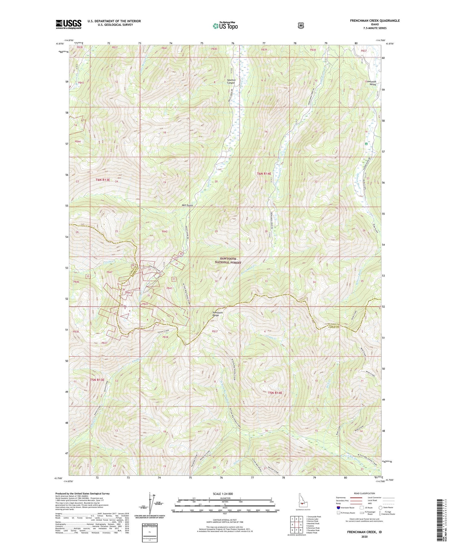
Frenchman Creek Idaho US Topo Map
Couldn't load pickup availability
Also explore the Frenchman Creek Forest Service Topo of this same quad for updated USFS data
2024 topographic map quadrangle Frenchman Creek in the state of Idaho. Scale: 1:24000. Based on the newly updated USGS 7.5' US Topo map series, this map is in the following counties: Blaine, Camas. The map contains contour data, water features, and other items you are used to seeing on USGS maps, but also has updated roads and other features. This is the next generation of topographic maps. Printed on high-quality waterproof paper with UV fade-resistant inks.
Quads adjacent to this one:
West: Marshall Peak
Northwest: Snowyside Peak
North: Alturas Lake
Northeast: Horton Peak
East: Galena
Southeast: Baker Peak
South: Paradise Peak
Southwest: Newman Peak
This map covers the same area as the classic USGS quad with code o43114g7.
Contains the following named places: Helen Creek, Loggy Creek, Mill Gulch, Mule Creek, Sawmill Canyon, Solace Mine, Vienna, Vienna Mine, Webfoot Mine


