MyTopo
Atlanta East Idaho US Topo Map
Couldn't load pickup availability
Also explore the Atlanta East Forest Service Topo of this same quad for updated USFS data
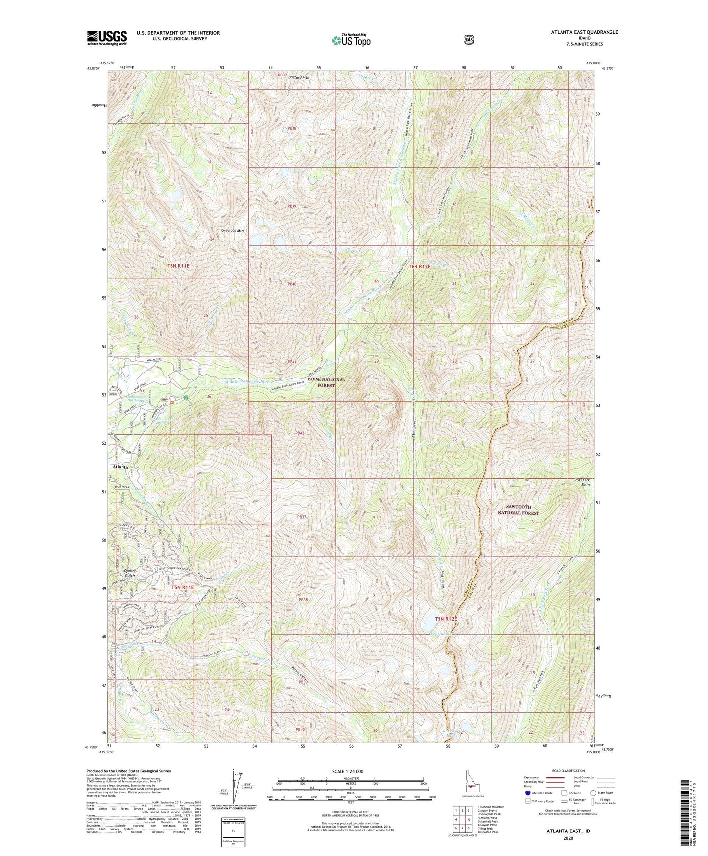
2023 topographic map quadrangle Atlanta East in the state of Idaho. Scale: 1:24000. Based on the newly updated USGS 7.5' US Topo map series, this map is in the following counties: Elmore, Camas. The map contains contour data, water features, and other items you are used to seeing on USGS maps, but also has updated roads and other features. This is the next generation of topographic maps. Printed on high-quality waterproof paper with UV fade-resistant inks.
Quads adjacent to this one:
West: Atlanta West
Northwest: Nahneke Mountain
North: Mount Everly
Northeast: Snowyside Peak
East: Marshall Peak
Southeast: Newman Peak
South: Ross Peak
Southwest: Cayuse Point
This map covers the same area as the classic USGS quad with code o43115g1.
Contains the following named places: Atlanta Hot Springs, Atlanta Pioneer Cemetery, Atlanta Recreation Site, Atlanta School, Blizzard Mountain, Chattanooga Hot Spring, Corral Creek, Flint Creek, Grays Creek, Greene Tree Dam, Greylock Creek, Greylock Mountain, Grouse Creek, Joe Daley Creek, La Moyne Creek, Leggit Creek, Leggit Lake, Lynx Creek, Mattingly Creek, Minerva Mine, Misfire Creek, Monarch Mine, Powerplant Campground, Ross Fork Lakes, Sawmill Creek, Snowslide Creek, Tolache Mine