MyTopo
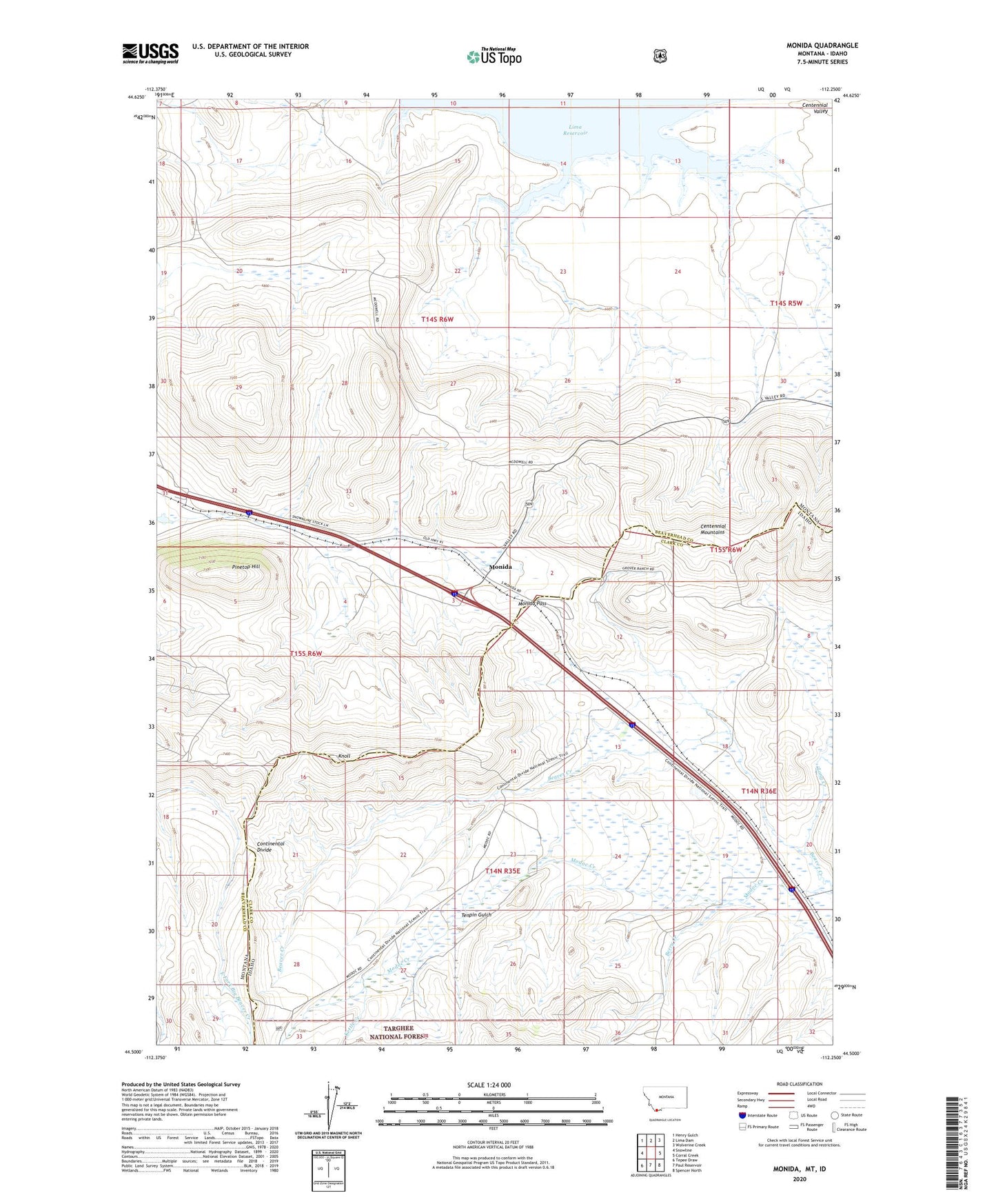
Monida Montana US Topo Map
Couldn't load pickup availability
Also explore the Monida Forest Service Topo of this same quad for updated USFS data
2024 topographic map quadrangle Monida in the states of Montana, Idaho. Scale: 1:24000. Based on the newly updated USGS 7.5' US Topo map series, this map is in the following counties: Beaverhead, Clark. The map contains contour data, water features, and other items you are used to seeing on USGS maps, but also has updated roads and other features. This is the next generation of topographic maps. Printed on high-quality waterproof paper with UV fade-resistant inks.
Quads adjacent to this one:
West: Snowline
Northwest: Henry Gulch
North: Lima Dam
Northeast: Wolverine Creek
East: Corral Creek
Southeast: Spencer North
South: Paul Reservoir
Southwest: Tepee Draw
This map covers the same area as the classic USGS quad with code o44112e3.
Contains the following named places: Berry Creek, Kettle Creek, Knoll, Long Creek, Modoc Creek, Monida, Monida Pass, Monida Post Office, Monida School, Pine Butte Station, Pinetop Hill, Tenpin Gulch