
MyTopo
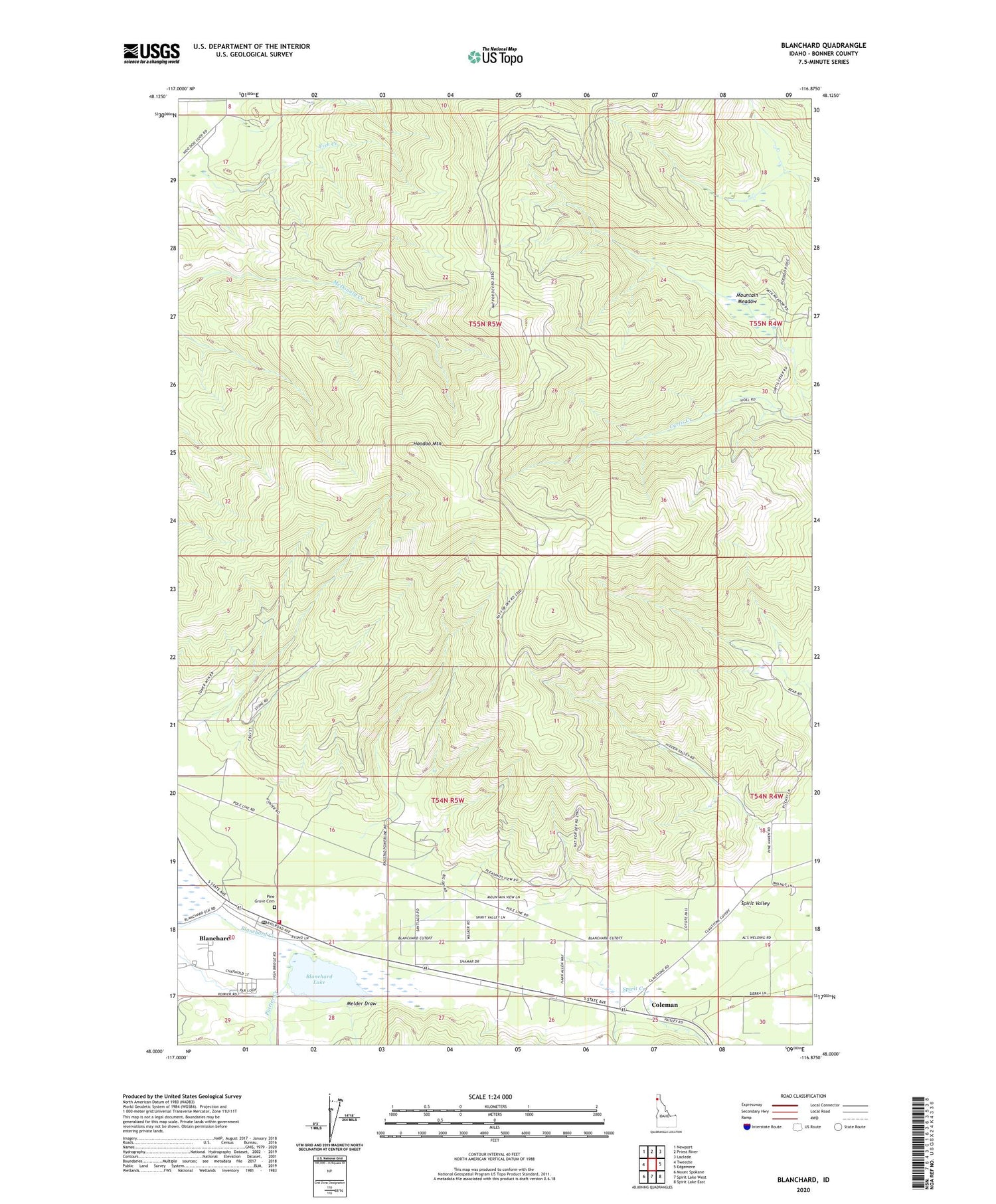
Blanchard Idaho US Topo Map
Couldn't load pickup availability
Also explore the Blanchard Forest Service Topo of this same quad for updated USFS data
2024 topographic map quadrangle Blanchard in the state of Idaho. Scale: 1:24000. Based on the newly updated USGS 7.5' US Topo map series, this map is in the following counties: Bonner. The map contains contour data, water features, and other items you are used to seeing on USGS maps, but also has updated roads and other features. This is the next generation of topographic maps. Printed on high-quality waterproof paper with UV fade-resistant inks.
Quads adjacent to this one:
West: Tweedie
Northwest: Newport
North: Priest River
Northeast: Laclede
East: Edgemere
Southeast: Spirit Lake East
South: Spirit Lake West
Southwest: Mount Spokane
This map covers the same area as the classic USGS quad with code o48116a8.
Contains the following named places: Blanchard, Blanchard Census Designated Place, Blanchard Creek, Blanchard Fire Station 2, Blanchard Lake, Blanchard Post Office, Coleman, Fish Creek, Hoodoo Mountain, Melder Draw, Mountain Meadow, Pine Grove Cemetery, Poirier Creek, Spirit Creek, ZIP Code: 83804


