MyTopo
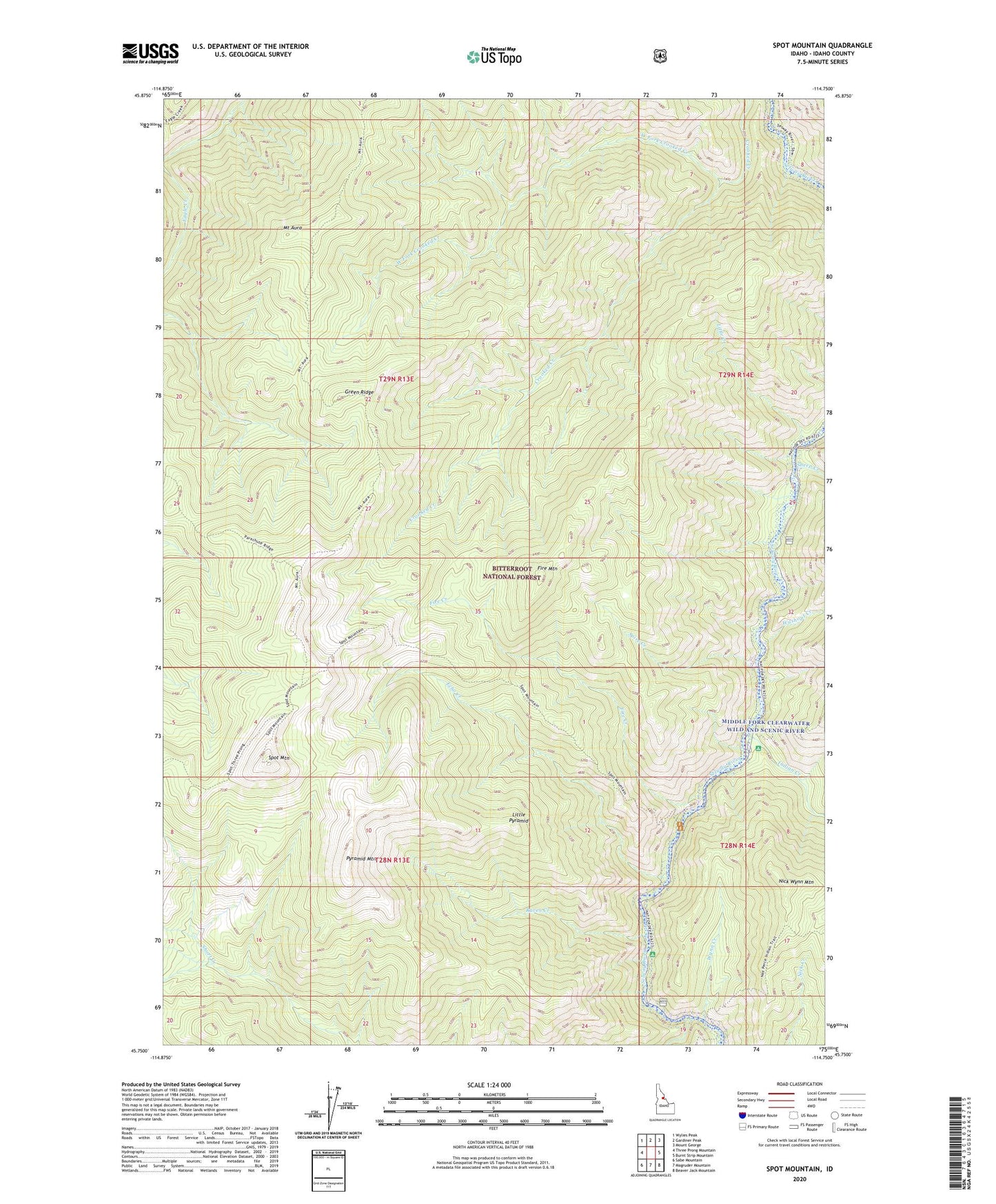
Spot Mountain Idaho US Topo Map
Couldn't load pickup availability
Also explore the Spot Mountain Forest Service Topo of this same quad for updated USFS data
2024 topographic map quadrangle Spot Mountain in the state of Idaho. Scale: 1:24000. Based on the newly updated USGS 7.5' US Topo map series, this map is in the following counties: Idaho. The map contains contour data, water features, and other items you are used to seeing on USGS maps, but also has updated roads and other features. This is the next generation of topographic maps. Printed on high-quality waterproof paper with UV fade-resistant inks.
Quads adjacent to this one:
West: Three Prong Mountain
Northwest: Wylies Peak
North: Gardiner Peak
Northeast: Mount George
East: Burnt Strip Mountain
Southeast: Beaver Jack Mountain
South: Magruder Mountain
Southwest: Sabe Mountain
This map covers the same area as the classic USGS quad with code o45114g7.
Contains the following named places: Echo Creek, Fire Creek, Fire Mountain, Green Ridge, Indian Creek, Indian Creek Campground, Little Clearwater River, Little Creek, Little Pyramid, Mount Aura, Nick Wynn Mountain, Pyramid Mountain, Raven Creek, Raven Creek Campground, Sheep Creek, Spire Creek, Spot Mountain, Washout Creek, West Fork Crooked Creek, Wynn Creek