MyTopo
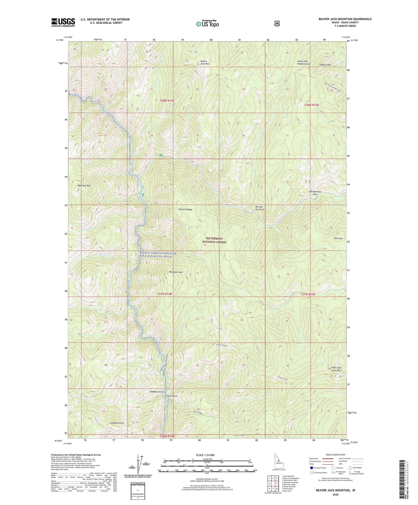
Beaver Jack Mountain Idaho US Topo Map
Couldn't load pickup availability
Also explore the Beaver Jack Mountain Forest Service Topo of this same quad for updated USFS data
2024 topographic map quadrangle Beaver Jack Mountain in the state of Idaho. Scale: 1:24000. Based on the newly updated USGS 7.5' US Topo map series, this map is in the following counties: Idaho. The map contains contour data, water features, and other items you are used to seeing on USGS maps, but also has updated roads and other features. This is the next generation of topographic maps. Printed on high-quality waterproof paper with UV fade-resistant inks.
Quads adjacent to this one:
West: Magruder Mountain
Northwest: Spot Mountain
North: Burnt Strip Mountain
Northeast: Watchtower Peak
East: Nez Perce Peak
Southeast: Blue Joint
South: Wood Hump
Southwest: Stripe Mountain
This map covers the same area as the classic USGS quad with code o45114f6.
Contains the following named places: Beaver Jack Mountain, Borrow Pit Gulch, Cache Creek, Cactus Creek, Cayuse Mountain, Deep Creek, Deep Creek Campground, Gabe Creek, Gold Pan Creek, Grass Gulch, Haystack Creek, Haystack Mountain, Hells Half Acre Creek, Hells Half Acre Mountain, Horsejaw Mountain, Kim Creek, Langdon Gulch, Langdon Point, Lunch Creek, Magruder Ranger Station, Old Warriors Face, Pasture Ridge, Pole Mountain, Scimitar Creek, Tepee Creek, Test Creek, Upper Crossing