MyTopo
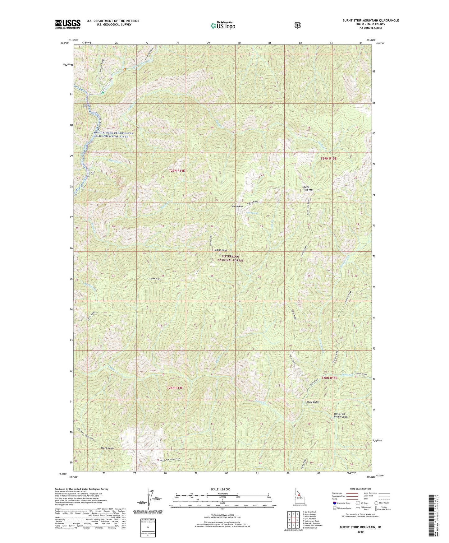
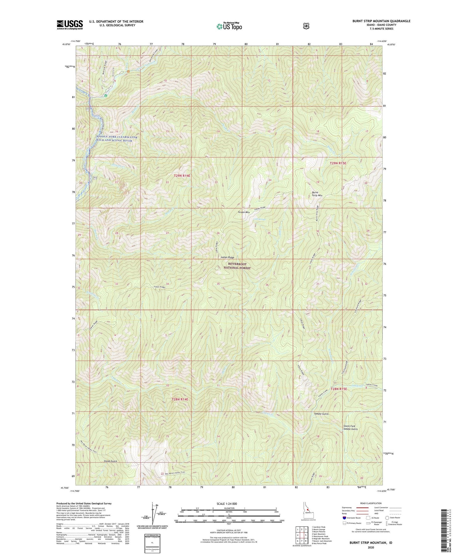
Burnt Strip Mountain Idaho US Topo Map
Couldn't load pickup availability
Also explore the Burnt Strip Mountain Forest Service Topo of this same quad for updated USFS data
2024 topographic map quadrangle Burnt Strip Mountain in the state of Idaho. Scale: 1:24000. Based on the newly updated USGS 7.5' US Topo map series, this map is in the following counties: Idaho. The map contains contour data, water features, and other items you are used to seeing on USGS maps, but also has updated roads and other features. This is the next generation of topographic maps. Printed on high-quality waterproof paper with UV fade-resistant inks.
Quads adjacent to this one:
West: Spot Mountain
Northwest: Gardiner Peak
North: Mount George
Northeast: Mount Paloma
East: Watchtower Peak
Southeast: Nez Perce Peak
South: Beaver Jack Mountain
Southwest: Magruder Mountain
This map covers the same area as the classic USGS quad with code o45114g6.
Contains the following named places: Burnt Strip Mountain, Cold Springs, Fitz Creek, Green Mountain, Indian Ridge, Jack Creek, Paradise Campground, Paradise Guard Station, Saddle Gulch, Schofield Creek, Snake Creek, South Fork Saddle Gulch, Stewart Creek, White Cap Creek, White Cap Trailhead