MyTopo
Magruder Mountain Idaho US Topo Map
Couldn't load pickup availability
Also explore the Magruder Mountain Forest Service Topo of this same quad for updated USFS data
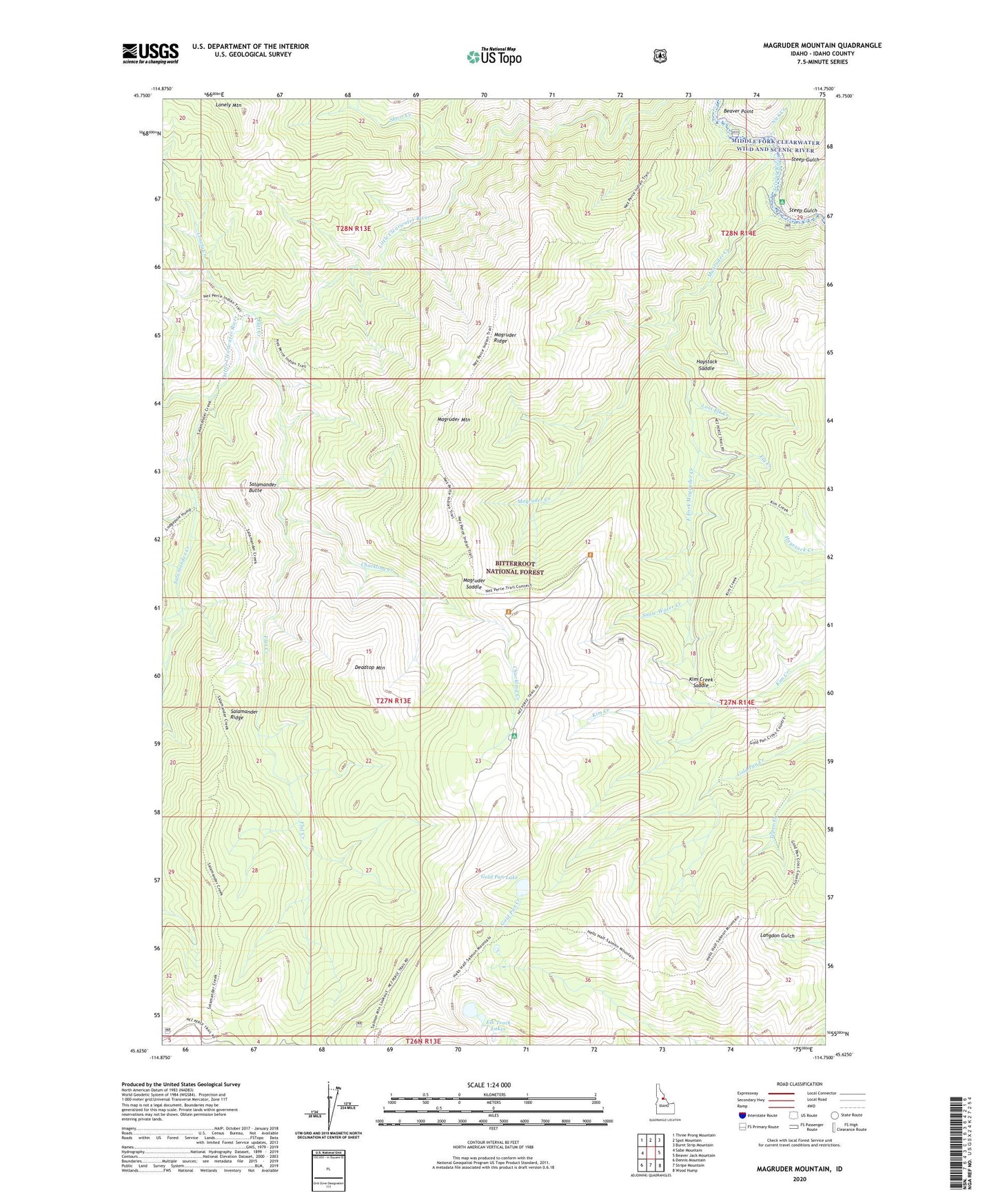
2024 topographic map quadrangle Magruder Mountain in the state of Idaho. Scale: 1:24000. Based on the newly updated USGS 7.5' US Topo map series, this map is in the following counties: Idaho. The map contains contour data, water features, and other items you are used to seeing on USGS maps, but also has updated roads and other features. This is the next generation of topographic maps. Printed on high-quality waterproof paper with UV fade-resistant inks.
Quads adjacent to this one:
West: Sabe Mountain
Northwest: Three Prong Mountain
North: Spot Mountain
Northeast: Burnt Strip Mountain
East: Beaver Jack Mountain
Southeast: Wood Hump
South: Stripe Mountain
Southwest: Dennis Mountain
This map covers the same area as the classic USGS quad with code o45114f7.
Contains the following named places: Beaver Point, Chuckling Creek, Deadtop Mountain, East Fork Magruder Creek, Elk Track Lakes, Ely Creek, Flat Creek, Gold Pan Lake, Haystack Saddle, Kim Creek Saddle, Lodge Creek, Lonely Creek, Lonely Mountain, Lost Elk Creek, Magruder Campground, Magruder Crossing, Magruder Massacre Site, Magruder Mountain, Magruder Ridge, Magruder Saddle, Nick Creek, Salamander Butte, Salamander Creek, Salamander Ridge, Short Creek, Snow Water Creek, Steep Gulch