MyTopo
Sweetwater Idaho US Topo Map
Couldn't load pickup availability
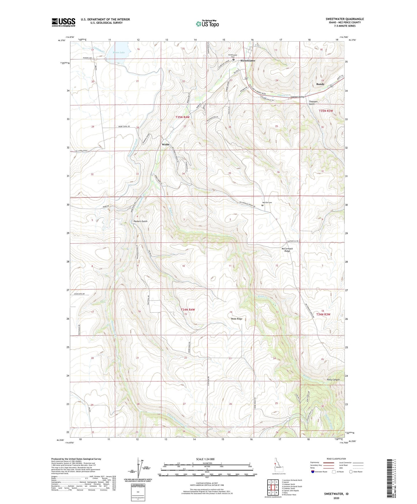
2024 topographic map quadrangle Sweetwater in the state of Idaho. Scale: 1:24000. Based on the newly updated USGS 7.5' US Topo map series, this map is in the following counties: Nez Perce. The map contains contour data, water features, and other items you are used to seeing on USGS maps, but also has updated roads and other features. This is the next generation of topographic maps. Printed on high-quality waterproof paper with UV fade-resistant inks.
Quads adjacent to this one:
West: Lewiston Orchards South
Northwest: Lewiston Orchards North
North: Lapwai
Northeast: Culdesac North
East: Culdesac South
Southeast: Winchester West
South: Waha
Southwest: Captain John Rapids
This map covers the same area as the classic USGS quad with code o46116c7.
Contains the following named places: Bundy, Bundy Station, East Fork Sweetwater Creek, Mann Lake, Mann Lake Public Fishing Area, McCormack Ridge, Nez Perce County, Packers Gulch, Polly Canyon, Red Elk Cemetery, Reservoir A Dam, Snow, Sweetwater, Sweetwater Canal, Sweetwater Cemetery, Sweetwater Census Designated Place, Sweetwater Creek, Thiessen Gulch, Webb, Webb Creek, Webb Creek Canal, Webb Ridge, West Fork Sweetwater Creek, William Craig Historical Monument, ZIP Code: 83540