MyTopo
Lapwai Idaho US Topo Map
Couldn't load pickup availability
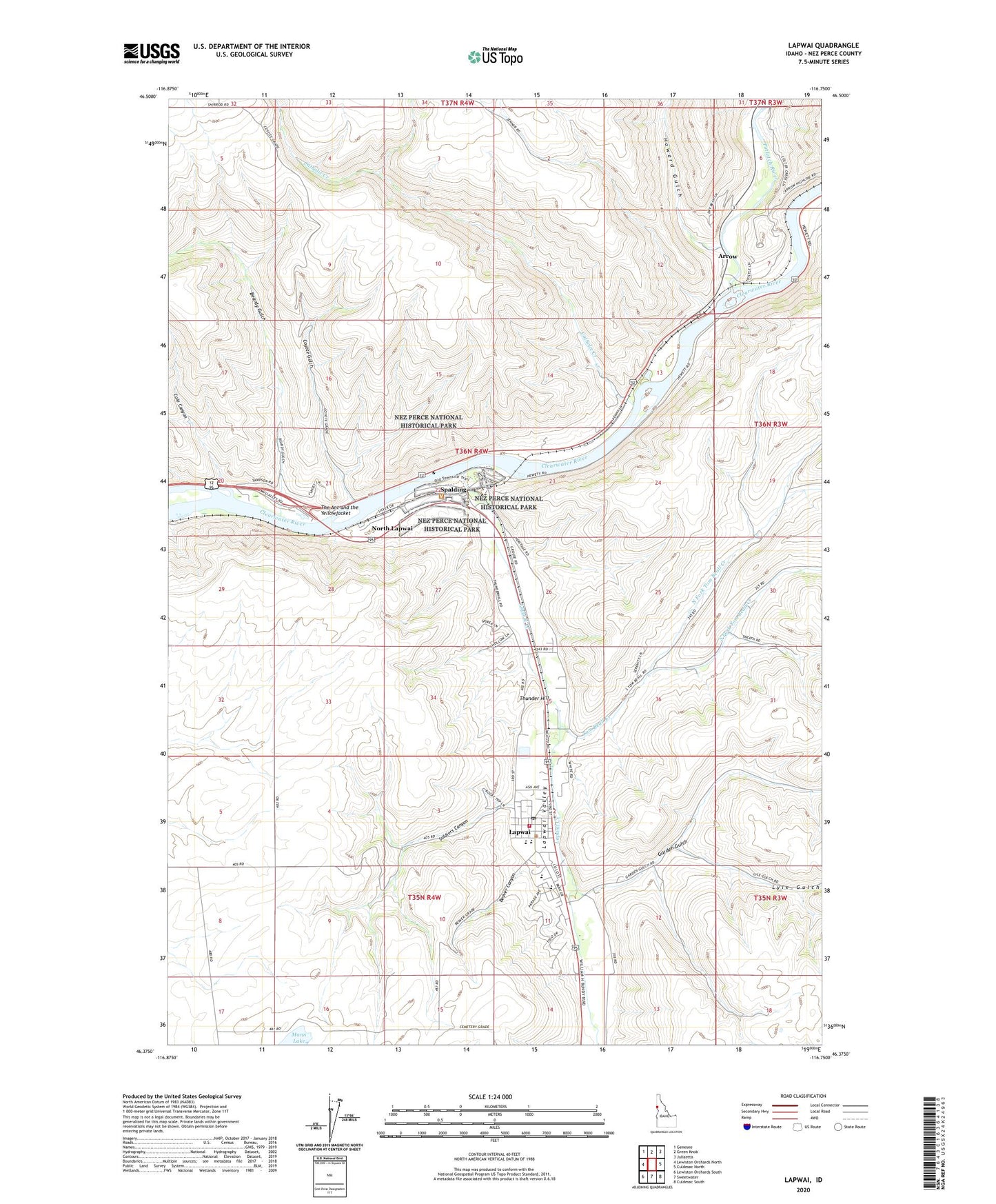
2024 topographic map quadrangle Lapwai in the state of Idaho. Scale: 1:24000. Based on the newly updated USGS 7.5' US Topo map series, this map is in the following counties: Nez Perce. The map contains contour data, water features, and other items you are used to seeing on USGS maps, but also has updated roads and other features. This is the next generation of topographic maps. Printed on high-quality waterproof paper with UV fade-resistant inks.
Quads adjacent to this one:
West: Lewiston Orchards North
Northwest: Genesee
North: Green Knob
Northeast: Juliaetta
East: Culdesac North
Southeast: Culdesac South
South: Sweetwater
Southwest: Lewiston Orchards South
This map covers the same area as the classic USGS quad with code o46116d7.
Contains the following named places: Arrow, Arrow Cemetery, Beardy Gulch, Beaver Canyon, Broncheau Family Cemetery, Catholic Creek, City of Lapwai, Cole Canyon, Coyote Grade Cemetery, Coyote Gulch, Fort Boise, Garden Gulch, Hog Island, Howard Gulch, Joseph, Lapwai, Lapwai Creek, Lapwai Elementary School, Lapwai Middle School, Lapwai Mission - Spalding Cemetery, Lapwai Post Office, Lapwai State Game Farm, Lapwai Valley, Lapwai Volunteer Fire Department, Lyle Gulch, Middle Fork Tom Beall Creek, Nez Perce National Historic Park - Spalding Area, North Fork Tom Beall Creek, North Idaho Indian Agency, North Lapwai, Potlatch River, Soldiers Canyon, South Fork Tom Beall Creek, Spalding, The Ant and the Yellowjacket, Thunder Hill, Tom Beall Creek