MyTopo
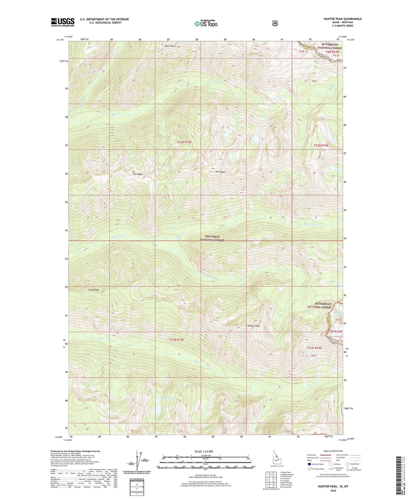
Hunter Peak Idaho US Topo Map
Couldn't load pickup availability
Also explore the Hunter Peak Forest Service Topo of this same quad for updated USFS data
2024 topographic map quadrangle Hunter Peak in the state of Idaho. Scale: 1:24000. Based on the newly updated USGS 7.5' US Topo map series, this map is in the following counties: Idaho, Ravalli. The map contains contour data, water features, and other items you are used to seeing on USGS maps, but also has updated roads and other features. This is the next generation of topographic maps. Printed on high-quality waterproof paper with UV fade-resistant inks.
Quads adjacent to this one:
West: Twin Butte
Northwest: Wahoo Peak
North: Saddle Mountain
Northeast: Tenmile Lake
East: El Capitan
Southeast: Tin Cup Lake
South: Mount Paloma
Southwest: Mount George
Contains the following named places: Bigfoot Lake, Diamond Lake, Elk Ridge, Granite Creek, Hunter Peak, Long Ridge, Moe Lake, Moe Peak, Rock Point, Spruce Creek, Spruce Lake