MyTopo
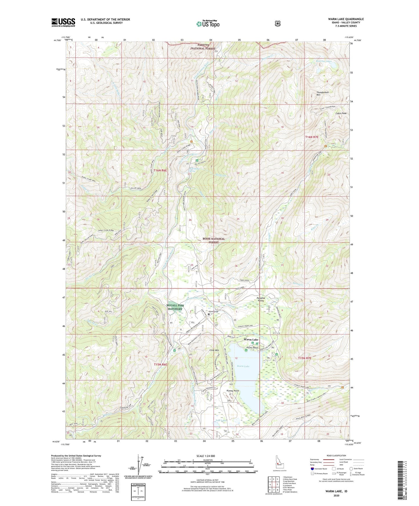
Warm Lake Idaho US Topo Map
Couldn't load pickup availability
Also explore the Warm Lake Forest Service Topo of this same quad for updated USFS data
2024 topographic map quadrangle Warm Lake in the state of Idaho. Scale: 1:24000. Based on the newly updated USGS 7.5' US Topo map series, this map is in the following counties: Valley. The map contains contour data, water features, and other items you are used to seeing on USGS maps, but also has updated roads and other features. This is the next generation of topographic maps. Printed on high-quality waterproof paper with UV fade-resistant inks.
Quads adjacent to this one:
West: Gold Fork Rock
Northwest: Blackmare
North: White Rock Peak
Northeast: Log Mountain
East: Landmark
Southeast: Tyndall Meadows
South: Rice Peak
Southwest: Oro Mountain
This map covers the same area as the classic USGS quad with code o44115f6.
Contains the following named places: Aunt Mellys Spring, Billy Rice Public Swimming Area, Cabin Creek, Cabin Peak, Cline Mountain, Curtis Creek, Dime Creek, Dollar Creek, Dollar Creek Way, Hayes Creek, Kinney Point, Kinney Point Summer Home Area, Kline Mine, Klines Grave, Knox, Knox Creek, Lakeshore Summer Home Area, McCall Fish Hatchery, Mirror Creek, Nickel Creek, North Fork Dollar Creek, North Shore Lodge Recreation Site, Paradise Valley, Paradise Valley Summer Home Area, Penny Spring Campground, Picnic Point, Picnic Point Campground, Reeves Creek, Roaring Creek, Roaring Lakes, Shoreline Boat Ramp, Shoreline Campground, Shoreline Drive Summer Home Area, Six-bit Creek, South Fork Salmon River Campground, Thunderbolt Mountain, Trail Creek, Tule Lake, Two-bit Creek, Warm Lake, Warm Lake Creek, Warm Lake Lodge Campground, Warm Lake Recreation Site