MyTopo
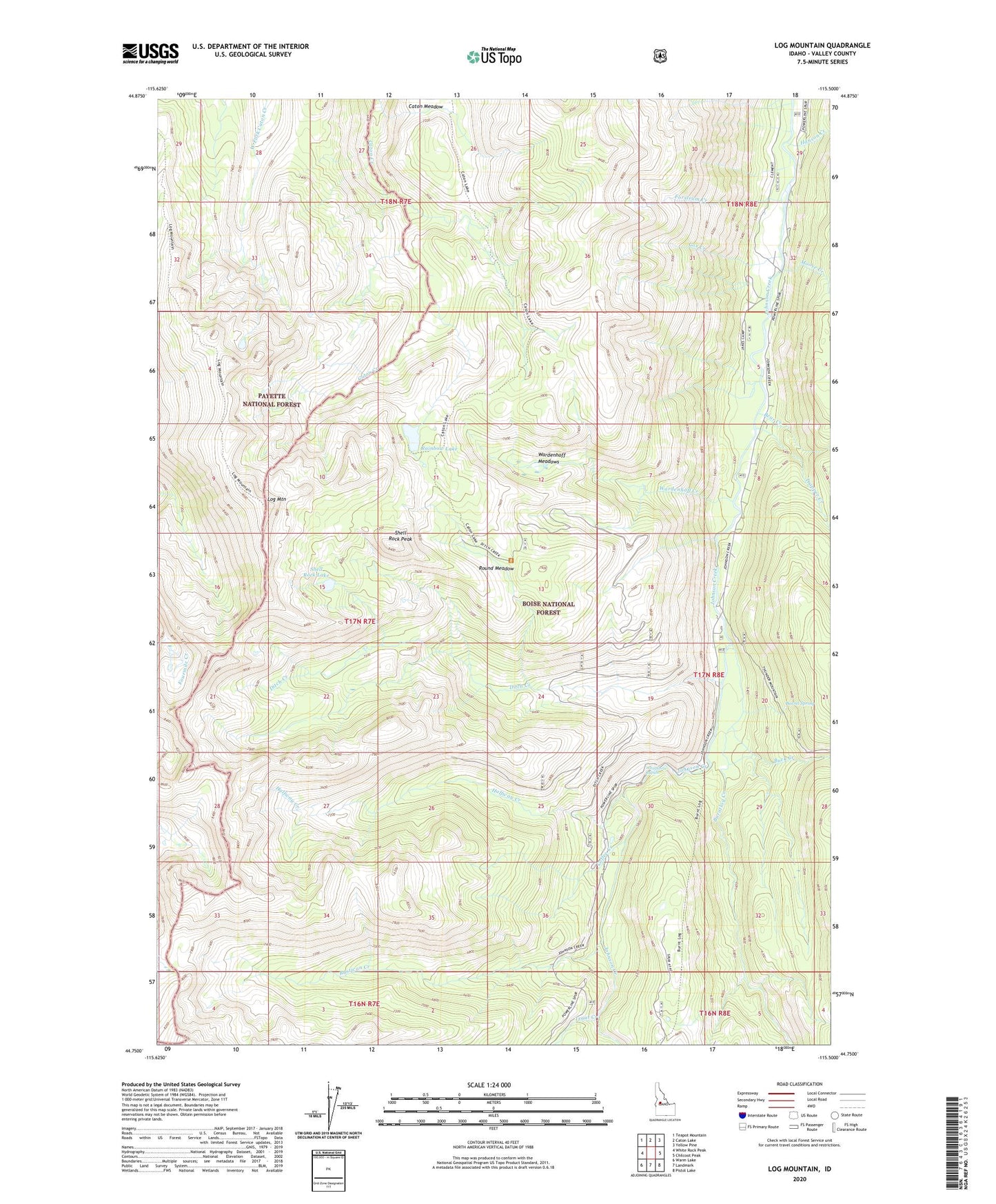
Log Mountain Idaho US Topo Map
Couldn't load pickup availability
Also explore the Log Mountain Forest Service Topo of this same quad for updated USFS data
2024 topographic map quadrangle Log Mountain in the state of Idaho. Scale: 1:24000. Based on the newly updated USGS 7.5' US Topo map series, this map is in the following counties: Valley. The map contains contour data, water features, and other items you are used to seeing on USGS maps, but also has updated roads and other features. This is the next generation of topographic maps. Printed on high-quality waterproof paper with UV fade-resistant inks.
Quads adjacent to this one:
West: White Rock Peak
Northwest: Teapot Mountain
North: Caton Lake
Northeast: Yellow Pine
East: Chilcoot Peak
Southeast: Pistol Lake
South: Landmark
Southwest: Warm Lake
This map covers the same area as the classic USGS quad with code o44115g5.
Contains the following named places: Barrel Spring, Bear Creek, Buck Creek, Burntlog Creek, Caton Lake Trail, Caton Meadow, Coffee Creek, Cox Creek, Ditch Creek, Ditch Creek Trail, Forstrum Creek, Halfway Creek, Halfway Station, Hanson Creek, Kitchen Creek, Log Mountain, Moose Creek, Rainbow Lake, Round Meadow, Rustican Creek, Shell Rock Lake, Shell Rock Peak, Trapper Creek, Trout Creek, Twin Bridges Campground, Valley County, Wardenhoff Creek, Wardenhoff Meadows, Whitehorse Rapids