MyTopo
Akin Illinois US Topo Map
Couldn't load pickup availability
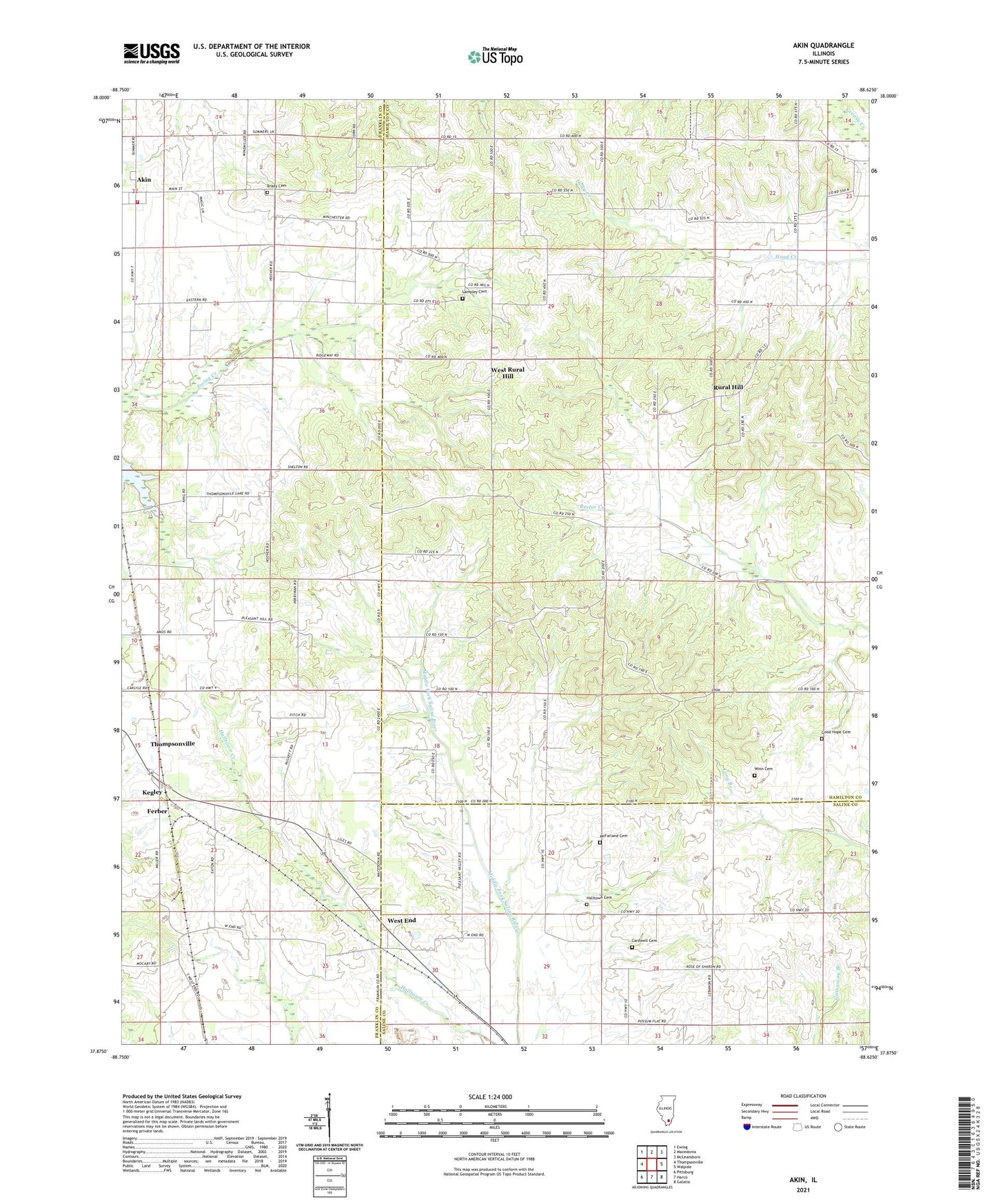
2024 topographic map quadrangle Akin in the state of Illinois. Scale: 1:24000. Based on the newly updated USGS 7.5' US Topo map series, this map is in the following counties: Hamilton, Franklin, Saline. The map contains contour data, water features, and other items you are used to seeing on USGS maps, but also has updated roads and other features. This is the next generation of topographic maps. Printed on high-quality waterproof paper with UV fade-resistant inks.
Quads adjacent to this one:
West: Thompsonville
Northwest: Ewing
North: Macedonia
Northeast: McLeansboro
East: Walpole
Southeast: Galatia
South: Harco
Southwest: Pittsburg
This map covers the same area as the classic USGS quad with code o37088h6.
Contains the following named places: Akin, Akin Post Office, Brady Cemetery, Cantrell School, Cardwell Cemetery, Cave Eastern Fire Protection District Station 2, Ferber, Fisher Bend School, Flannigan School, Flannigan Townhall, Good Hope Cemetery, Halltown, Halltown Cemetery, Kegley, Knob Prairie School, Lampley Cemetery, Lebanon Church, Liberty Church, Little Hill School, Little Springs Church, McFarland Cemetery, Oak Grove Church, Oakgrove School, Pleasant Hill Church, Pleasant Hill School, Pleasant Valley Church, Rural Hill, Rural Hill School, Saul School, South Flannigan Townhall, Tate Townhall, Thistle Ridge School, Thompsonville Lake, Township of Flannigan, Township of South Flannigan, Township of Tate, West End, West End Disposal Facility, West Rural Hill, Winn Cemetery, WQRL-FM (Benton), ZIP Code: 62890