MyTopo
Harco Illinois US Topo Map
Couldn't load pickup availability
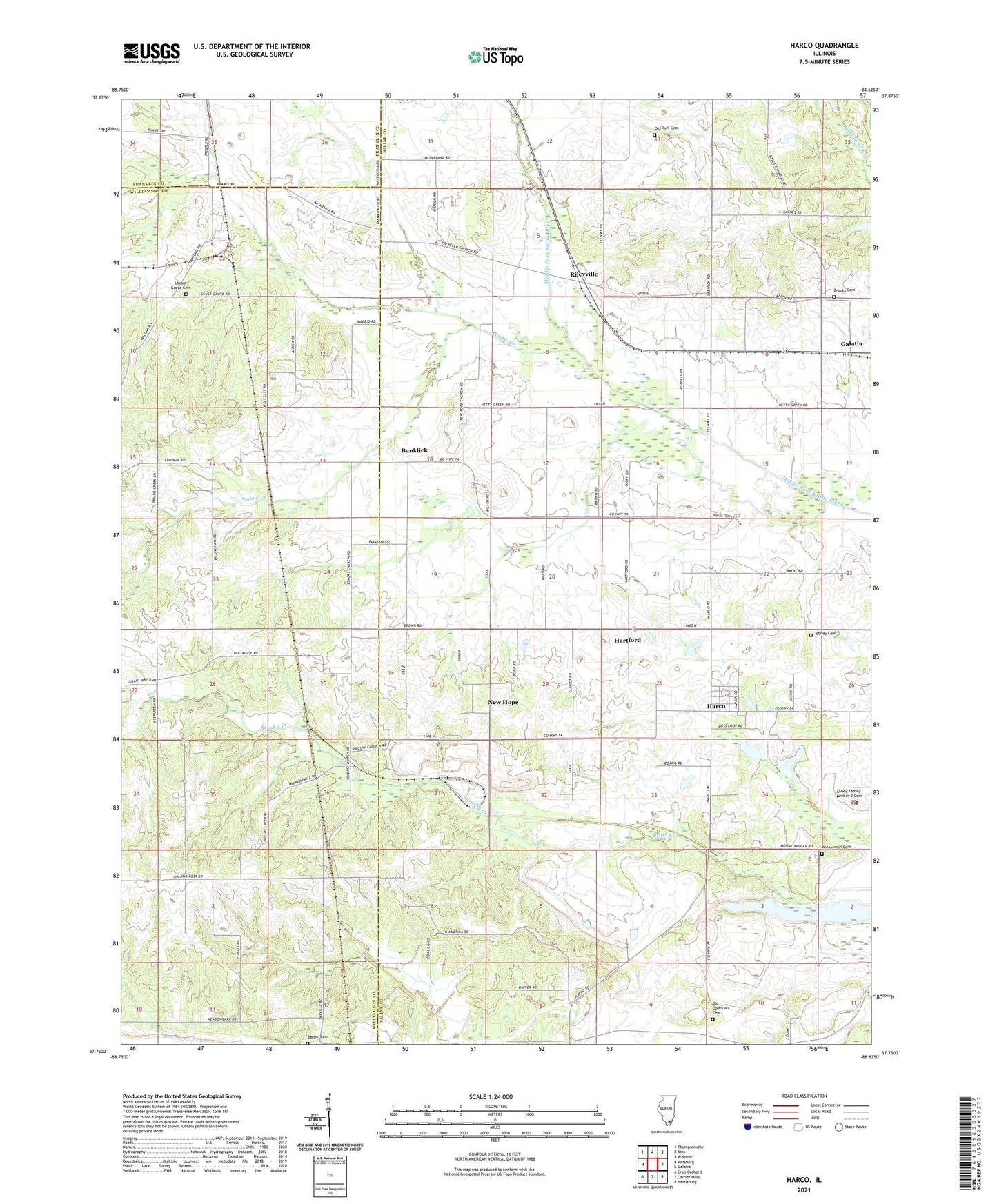
2024 topographic map quadrangle Harco in the state of Illinois. Scale: 1:24000. Based on the newly updated USGS 7.5' US Topo map series, this map is in the following counties: Saline, Williamson, Franklin. The map contains contour data, water features, and other items you are used to seeing on USGS maps, but also has updated roads and other features. This is the next generation of topographic maps. Printed on high-quality waterproof paper with UV fade-resistant inks.
Quads adjacent to this one:
West: Pittsburg
Northwest: Thompsonville
North: Akin
Northeast: Walpole
East: Galatia
Southeast: Harrisburg
South: Carrier Mills
Southwest: Crab Orchard
This map covers the same area as the classic USGS quad with code o37088g6.
Contains the following named places: Abney Cemetery, Abney Family Number 2 Cemetery, Allens Chapel, Banklick, Bankston Fork Church, Barter Cemetery, Bethel Church, Brooks Cemetery, Brushy Church, Dillingham Church, Ebenezer Cemetery, Ebenezer Church, Ebenezer School, Halltown Creek, Harco, Hartford, Liberty Church, Locust Grove, Locust Grove Cemetery, Martin Swine Farm, New Hope, New Hope Church, New Hope School, North American Church, Old Ebenezer Cemetery, Old Ruff Cemetery, Prairie Creek, Rileyville, Spring Grove Church, Summers Church, Township of Brushy, Township of Galatia, Union Grove Church, Ward School, WBVN-FM (Carrier Mills), Winkleman Cemetery, ZIP Code: 62935