MyTopo
Pittsburg Illinois US Topo Map
Couldn't load pickup availability
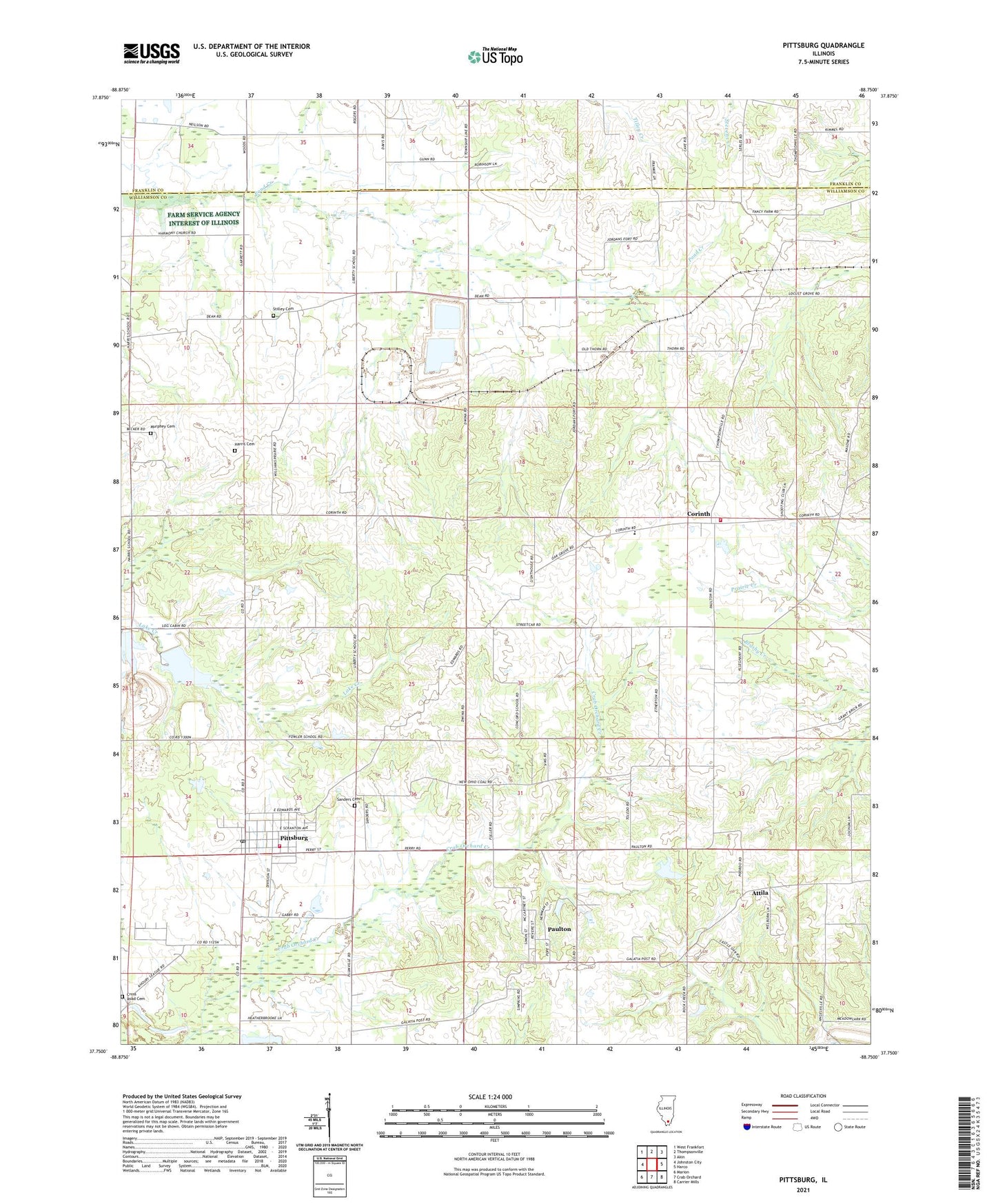
2024 topographic map quadrangle Pittsburg in the state of Illinois. Scale: 1:24000. Based on the newly updated USGS 7.5' US Topo map series, this map is in the following counties: Williamson, Franklin. The map contains contour data, water features, and other items you are used to seeing on USGS maps, but also has updated roads and other features. This is the next generation of topographic maps. Printed on high-quality waterproof paper with UV fade-resistant inks.
Quads adjacent to this one:
West: Johnston City
Northwest: West Frankfort
North: Thompsonville
Northeast: Akin
East: Harco
Southeast: Carrier Mills
South: Crab Orchard
Southwest: Marion
This map covers the same area as the classic USGS quad with code o37088g7.
Contains the following named places: Attila, Cedar Grove Church, Center School, Christian Chapel, Church of God, Concord School, Corinth, Corinth Election Precinct, County Line Church, Cross Road Cemetery, Fresh Water Lake, Fresh Water Lake Impoundment Structure Dam, Halfway, Harris Cemetery, Illinois No Name Number 14 Dam, Johnston City Lake, Johnston City Reservoir Dam, Lake Creek Election Precinct, Liberty Church, Lincoln Elementary School, Murphey Cemetery, Number 8 Chapel, Oak Hill Post Office, Paulton, Pittsburg, Pittsburg Post Office, Pittsburg Volunteer Fire Department, Pleasant Grove Church, Plumville Church, Sanders Cemetery, Shiloh Church, Stilley Cemetery, Tulley School, Union Grove Church, Union Grove School, Village of Pittsburg, WDDD-AM (Johnston City), Williams Prairie Church, Williamson County Fire Protection District Station 4, ZIP Code: 62974