MyTopo
Ewing Illinois US Topo Map
Couldn't load pickup availability
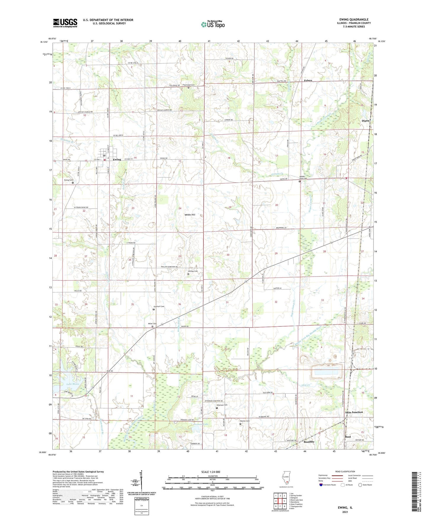
2024 topographic map quadrangle Ewing in the state of Illinois. Scale: 1:24000. Based on the newly updated USGS 7.5' US Topo map series, this map is in the following counties: Franklin. The map contains contour data, water features, and other items you are used to seeing on USGS maps, but also has updated roads and other features. This is the next generation of topographic maps. Printed on high-quality waterproof paper with UV fade-resistant inks.
Quads adjacent to this one:
West: Rend Lake Dam
Northwest: Ina
North: Spring Garden
Northeast: Dahlgren
East: Macedonia
Southeast: Akin
South: Thompsonville
Southwest: West Frankfort
This map covers the same area as the classic USGS quad with code o38088a7.
Contains the following named places: Akin Creek, Akin Junction, Boothby, Cuba School, Diana, Ewing, Ewing - Northern Fire Protection District Station 1, Ewing - Northern Fire Protection District Station 2, Ewing Cemetery, Ewing-Northern Elementary School, Franklin School, Frisco, Goose Creek, Granny Creek, Hickory Hill School, Independence School, Jordan Creek, Lake Moses, Lake Moses Dam, Liberty Church, Long Prairie School, Manion Cemetery, Manion School, Middle Fork Cemetery, Miller Cemetery, Mount Zion Church, Mount Zion School, Odum Spur, Old Akin School, Otterson Cemetery, Overturf Cemetery, Phillips Cemetery, Rust, Stockwell School, Sugar Camp Creek, Sugarcamp School, Taylor Branch, Taylor Hill, Taylor Hill Post Office, Taylor Hill School, Thurmond Cemetery, Township of Ewing, Township of Northern, University of Illinois Experimental Farm, Vernons Lake, Village of Ewing, Webbs Hill, Webbs Hill Branch, Webbs Prairie Church, Webbs Prairie Post Office, Webbs Prairie School, Williams Chapel, ZIP Code: 62836