MyTopo
Literberry Illinois US Topo Map
Couldn't load pickup availability
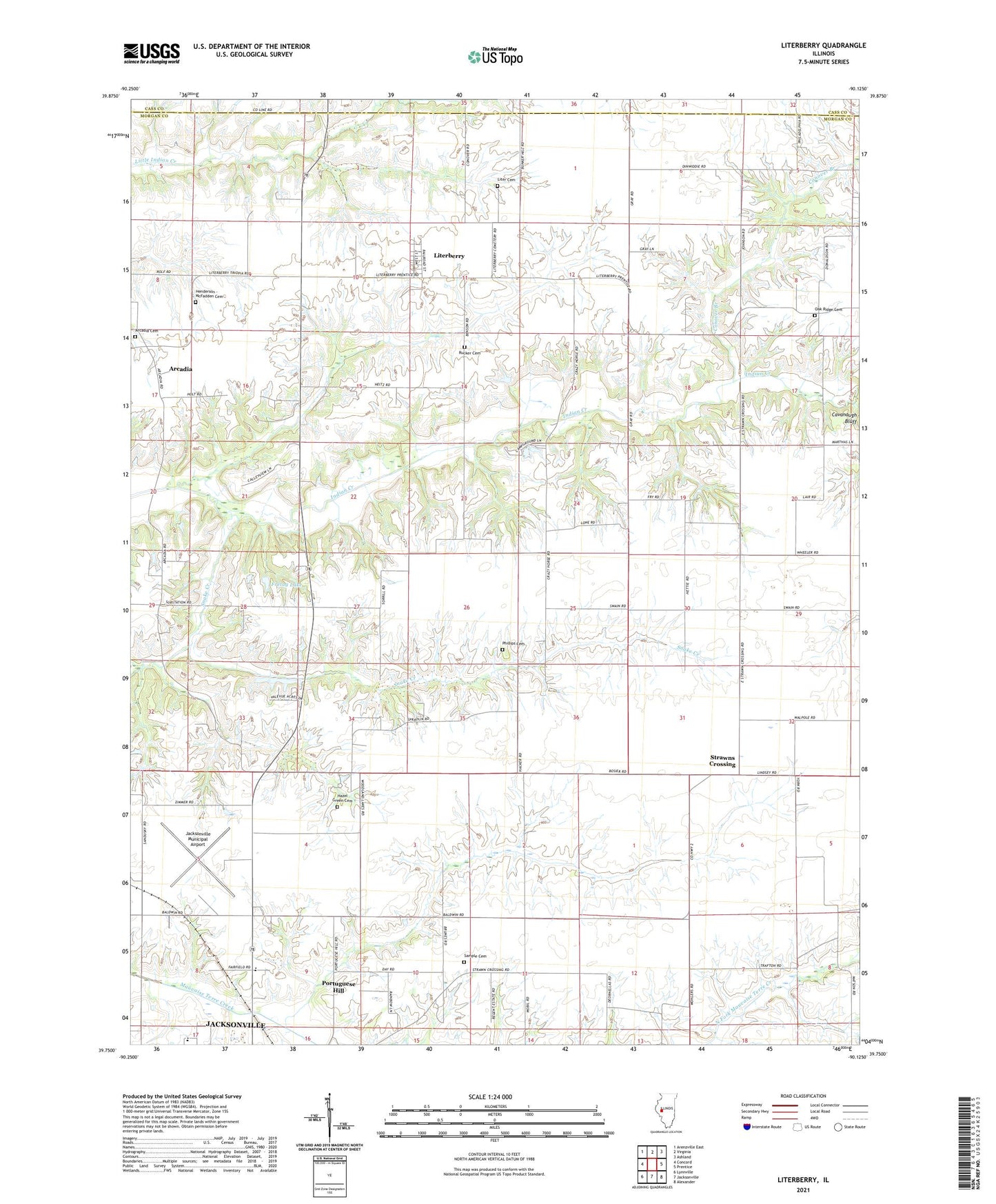
2024 topographic map quadrangle Literberry in the state of Illinois. Scale: 1:24000. Based on the newly updated USGS 7.5' US Topo map series, this map is in the following counties: Morgan, Cass. The map contains contour data, water features, and other items you are used to seeing on USGS maps, but also has updated roads and other features. This is the next generation of topographic maps. Printed on high-quality waterproof paper with UV fade-resistant inks.
Quads adjacent to this one:
West: Concord
Northwest: Arenzville East
North: Virginia
Northeast: Ashland
East: Prentice
Southeast: Alexander
South: Jacksonville
Southwest: Lynnville
This map covers the same area as the classic USGS quad with code o39090g2.
Contains the following named places: Arcadia, Arcadia Cemetery, Arcadia Church, Brownton, Brush College School, Cavanaugh Bluff, Clark Chapel, Conover Branch, Crazy Horse Campground, Fretag Lake, Fretag Lake Dam, Hazel Green Cemetery, Henderson - McFadden Cemetery, Hickory Grove School, Independence School, Jacksonville High School, Jacksonville Municipal Airport, Liter Cemetery, Literberry, Literberry Census Designated Place, Literberry Election Precinct, Literberry Post Office, Little Indian Creek, Mauvaise Terre School, North Jacksonville School, North Oakland School, Oak Ridge Cemetery, Oak Ridge School, Phillips Cemetery, Portuguese Hill, Prairie Union School, Rucker Cemetery, Sample Cemetery, Savage, Sherman School, Snake Creek, Strawns Crossing, Trinidad School, Union Grove School, Valevue Lake, Valevue Lake Dam