MyTopo
Arthur Illinois US Topo Map
Couldn't load pickup availability
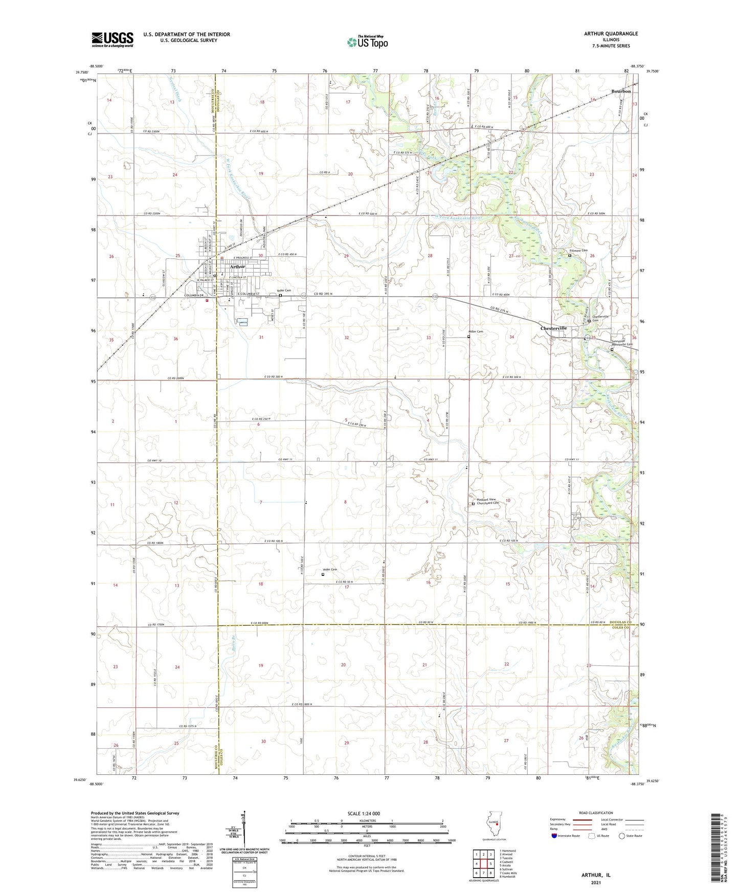
2024 topographic map quadrangle Arthur in the state of Illinois. Scale: 1:24000. Based on the newly updated USGS 7.5' US Topo map series, this map is in the following counties: Douglas, Moultrie, Coles. The map contains contour data, water features, and other items you are used to seeing on USGS maps, but also has updated roads and other features. This is the next generation of topographic maps. Printed on high-quality waterproof paper with UV fade-resistant inks.
Quads adjacent to this one:
West: Cadwell
Northwest: Hammond
North: Atwood
Northeast: Tuscola
East: Arcola
Southeast: Humboldt
South: Cooks Mills
Southwest: Sullivan
This map covers the same area as the classic USGS quad with code o39088f4.
Contains the following named places: Arthur, Arthur Ambulance Service, Arthur Church of Christ, Arthur Elementary School, Arthur Fire Department, Arthur Mennonite Church, Arthur Police Department, Arthur Post Office, Arthur Public Library, Arthur Senior High School, Arthur Town Hall, Arthur United Methodist Church, Bagdad School, Bear Creek, Bolinger School, Bourbon, Bourbon Post Office, Chesterville, Chesterville Post Office, Chesterville School, Columbia School, Cooks Mills Consolidated Oil Field, De Hart School, East Prairie School, Fillmore, Fillmore Cemetery, First Apostolic Church, First Baptist Church, German School, Lake Fork, Lake Fork Special Ditch, Larry D Herschberger Airport, Liberty School, Lilly School, McDonald School, Mennonite School, Miller Cemetery, North Side School, Otto School, Pleasant View Church, Prairie Lane School, Reeder School, Rockome Gardens, Shady Crest Orchard, Shaw School, South Prairie School, Township of Bourbon, Union Prairie Church, Village of Arthur, Vine Street Christian Church, West Fork Kaskaskia River, West Prairie School, Yoder Cemetery, Yoder School, ZIP Code: 61911