MyTopo
Humboldt Illinois US Topo Map
Couldn't load pickup availability
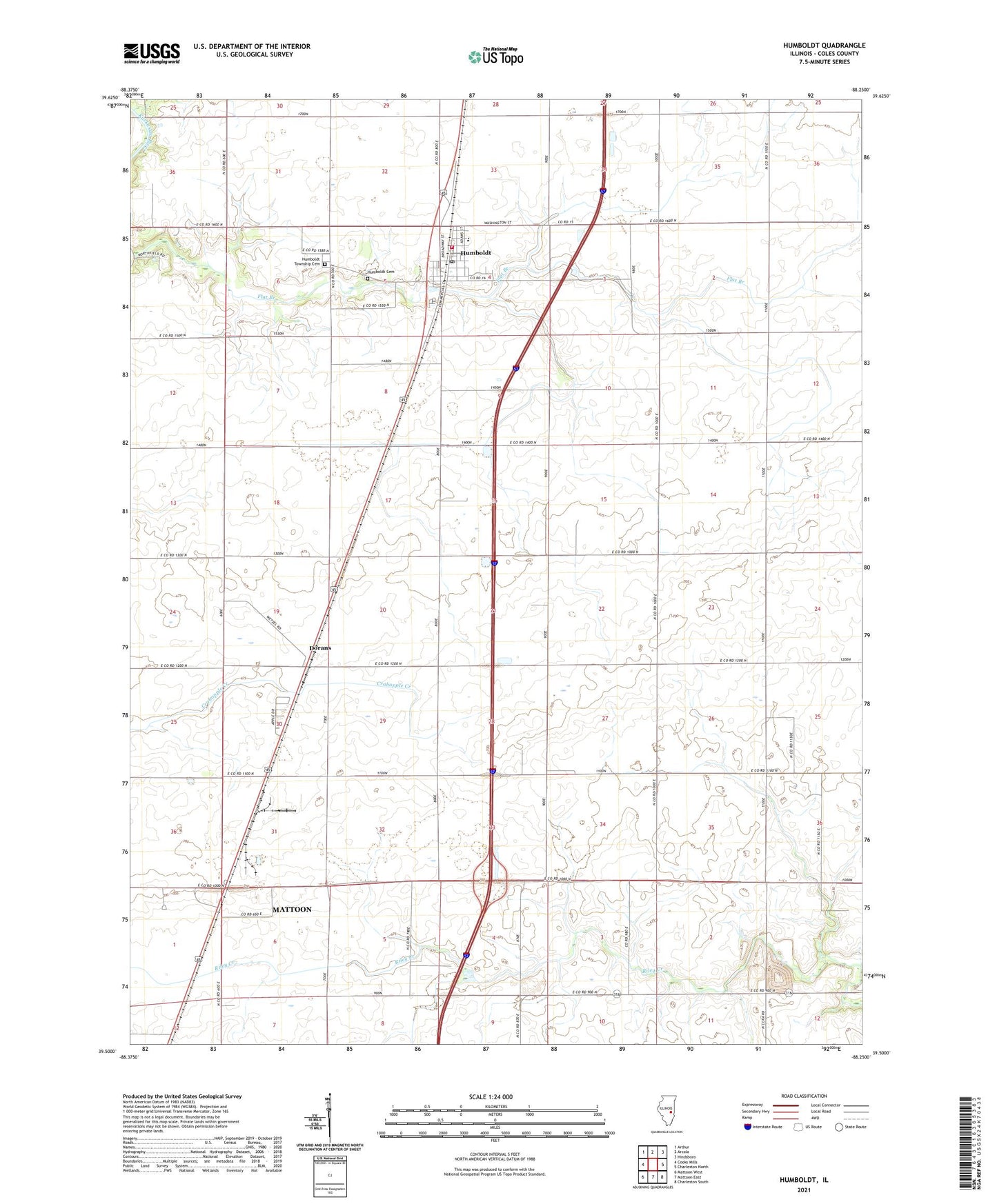
2024 topographic map quadrangle Humboldt in the state of Illinois. Scale: 1:24000. Based on the newly updated USGS 7.5' US Topo map series, this map is in the following counties: Coles. The map contains contour data, water features, and other items you are used to seeing on USGS maps, but also has updated roads and other features. This is the next generation of topographic maps. Printed on high-quality waterproof paper with UV fade-resistant inks.
Quads adjacent to this one:
West: Cooks Mills
Northwest: Arthur
North: Arcola
Northeast: Hindsboro
East: Charleston North
Southeast: Charleston South
South: Mattoon East
Southwest: Mattoon West
This map covers the same area as the classic USGS quad with code o39088e3.
Contains the following named places: Antioch School, Bean School, Black School, Bond School, Dorans, Floyd School, Frazier School, Humboldt, Humboldt Cemetery, Humboldt Community Fire Protection District, Humboldt Elementary School, Humboldt Post Office, Humboldt Township Cemetery, North Loxa School, Oak Grove School, Pleasant View School, Poorman School, Saint Pauls Church, Swayback School, Tinch School, Township of Humboldt, Village of Humboldt, Wesley School, WLBH-AM (Mattoon), WLBH-FM (Mattoon), WMCI-FM (Mattoon), Zion School, ZIP Code: 61931