MyTopo
Arcola Illinois US Topo Map
Couldn't load pickup availability
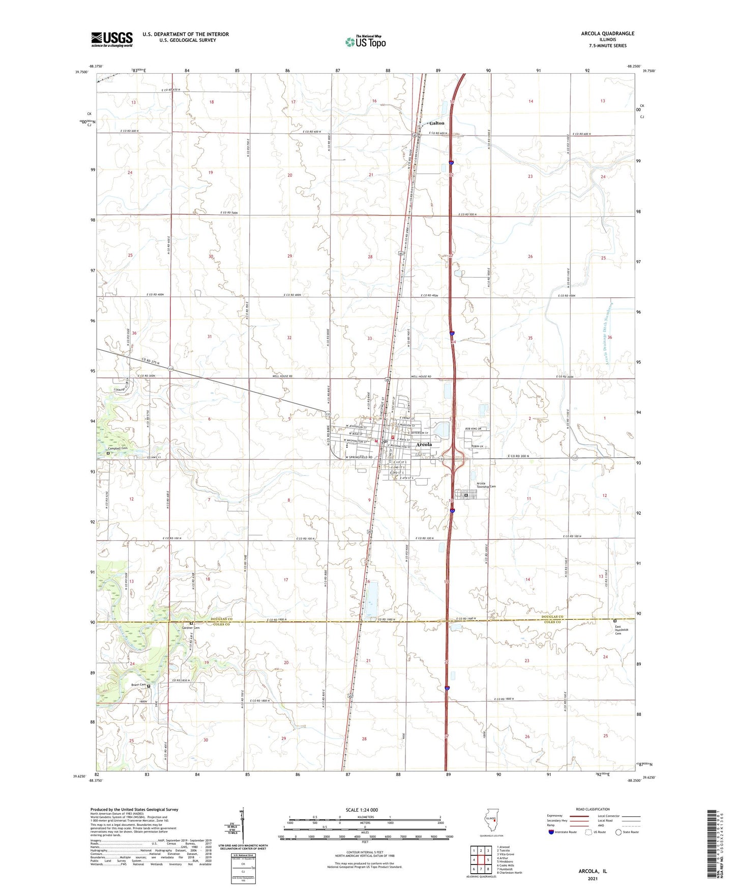
2024 topographic map quadrangle Arcola in the state of Illinois. Scale: 1:24000. Based on the newly updated USGS 7.5' US Topo map series, this map is in the following counties: Douglas, Coles. The map contains contour data, water features, and other items you are used to seeing on USGS maps, but also has updated roads and other features. This is the next generation of topographic maps. Printed on high-quality waterproof paper with UV fade-resistant inks.
Quads adjacent to this one:
West: Arthur
Northwest: Atwood
North: Tuscola
Northeast: Villa Grove
East: Hindsboro
Southeast: Charleston North
South: Humboldt
Southwest: Cooks Mills
This map covers the same area as the classic USGS quad with code o39088f3.
Contains the following named places: Allison School, Arcola, Arcola City Hall, Arcola Fire Protection District, Arcola Fire Protection District Town Hall Station, Arcola High School, Arcola Police Department, Arcola Post Office, Arcola Presbyterian Church, Arcola Public Library, Arcola Township Cemetery, Arcola United Methodist Church, Arcola Water Works, Brann Cemetery, Campbell Cemetery, City of Arcola, Cofer School, East Humboldt Cemetery, East Side Public School, First Baptist Church of Arcola, First Christian Church, Free Methodist Episcopal Church, Galton, Galton School, Gardner Cemetery, Hartford School, Maple Grove School, Moore Memorial Park, Nazarene Church, Pulltight School, Saint Johns Catholic Church, Scales School, Shrader Ambulance Service, Township of Arcola, Union Central School, Welch School, West Side Public School, ZIP Code: 61910