MyTopo
Cadwell Illinois US Topo Map
Couldn't load pickup availability
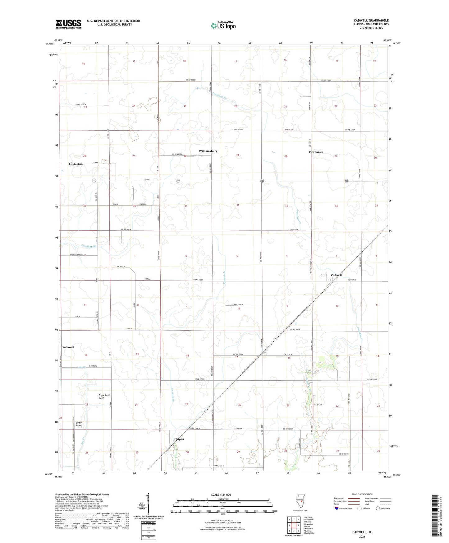
2024 topographic map quadrangle Cadwell in the state of Illinois. Scale: 1:24000. Based on the newly updated USGS 7.5' US Topo map series, this map is in the following counties: Moultrie. The map contains contour data, water features, and other items you are used to seeing on USGS maps, but also has updated roads and other features. This is the next generation of topographic maps. Printed on high-quality waterproof paper with UV fade-resistant inks.
Quads adjacent to this one:
West: Lovington
Northwest: La Place
North: Hammond
Northeast: Atwood
East: Arthur
Southeast: Cooks Mills
South: Sullivan
Southwest: Kirksville
This map covers the same area as the classic USGS quad with code o39088f5.
Contains the following named places: Boggs School, Cadwell, Center School, Chipps, Cushman, Durbin Airport, Dyer School, Eagle Lake Basin, Fairbanks, Fairview School, German School, Grandview School, Jonathan Creek School, Jonathan Creek Townhall, Lowe Townhall, Mentzer School, Merit School, Minor School, Morning Star School, Moultrie County, Plainview School, Rosedale School, Seass Cemetery, Township of Jonathan Creek, Township of Lowe, Twomile School, White School, Williamsburg, WKJR-FM (Sullivan)