MyTopo
Ashley Illinois US Topo Map
Couldn't load pickup availability
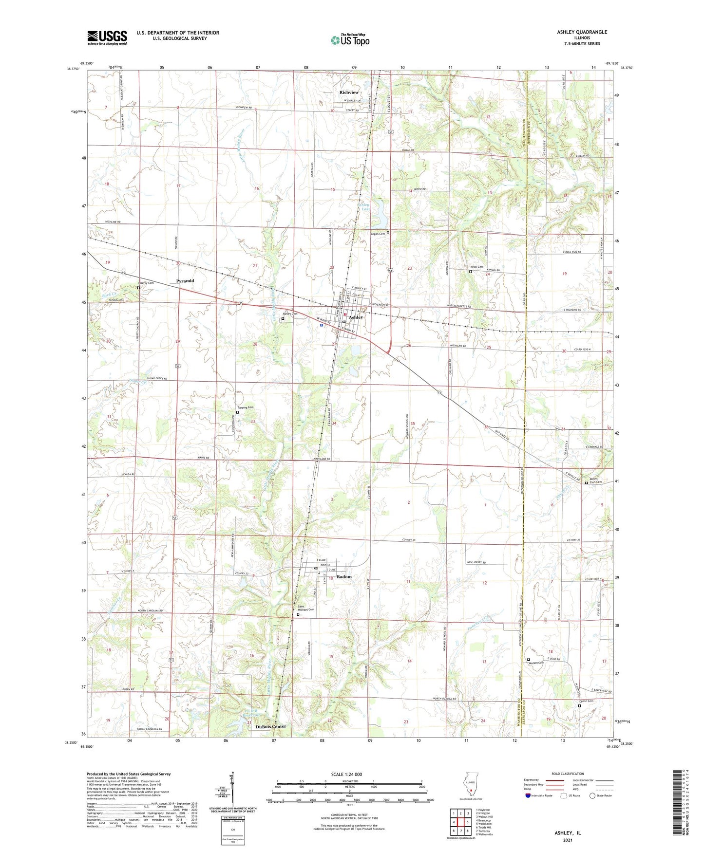
2024 topographic map quadrangle Ashley in the state of Illinois. Scale: 1:24000. Based on the newly updated USGS 7.5' US Topo map series, this map is in the following counties: Washington, Jefferson. The map contains contour data, water features, and other items you are used to seeing on USGS maps, but also has updated roads and other features. This is the next generation of topographic maps. Printed on high-quality waterproof paper with UV fade-resistant inks.
Quads adjacent to this one:
West: Beaucoup
Northwest: Hoyleton
North: Irvington
Northeast: Walnut Hill
East: Woodlawn
Southeast: Waltonville
South: Tamaroa
Southwest: Todds Mill
This map covers the same area as the classic USGS quad with code o38089c2.
Contains the following named places: Ashley, Ashley Baptist Church, Ashley Cemetery, Ashley Community Consolidated School, Ashley Dam, Ashley Fire Protection District, Ashley Lake, Ashley Oil Field, Ashley Police Department, Ashley Post Office, Ashley Reservoir, Brick Cemetery, Brick School, Casner School, City of Ashley, Dry Arm School, Du Bois Oil Field, DuBois Center, Fairview Church, Fairview School, Flannigan School, Howard School, I C R R Reservoir, I C R R Reservoir Dam, Liberty Cemetery, Liberty School, Logan Cemetery, Minson Cemetery, Minson Church, Mount Zion Cemetery, Mount Zion Church, Old Town School, Pyramid, Quinn Cemetery, Radom, Radom Post Office, Saint Michael Cemetery, Topping Cemetery, Township of Ashley, Township of Du Bois, Township of Richview, Union Church, Village of Radom, White Swan School, ZIP Codes: 62808, 62876