MyTopo
Hoyleton Illinois US Topo Map
Couldn't load pickup availability
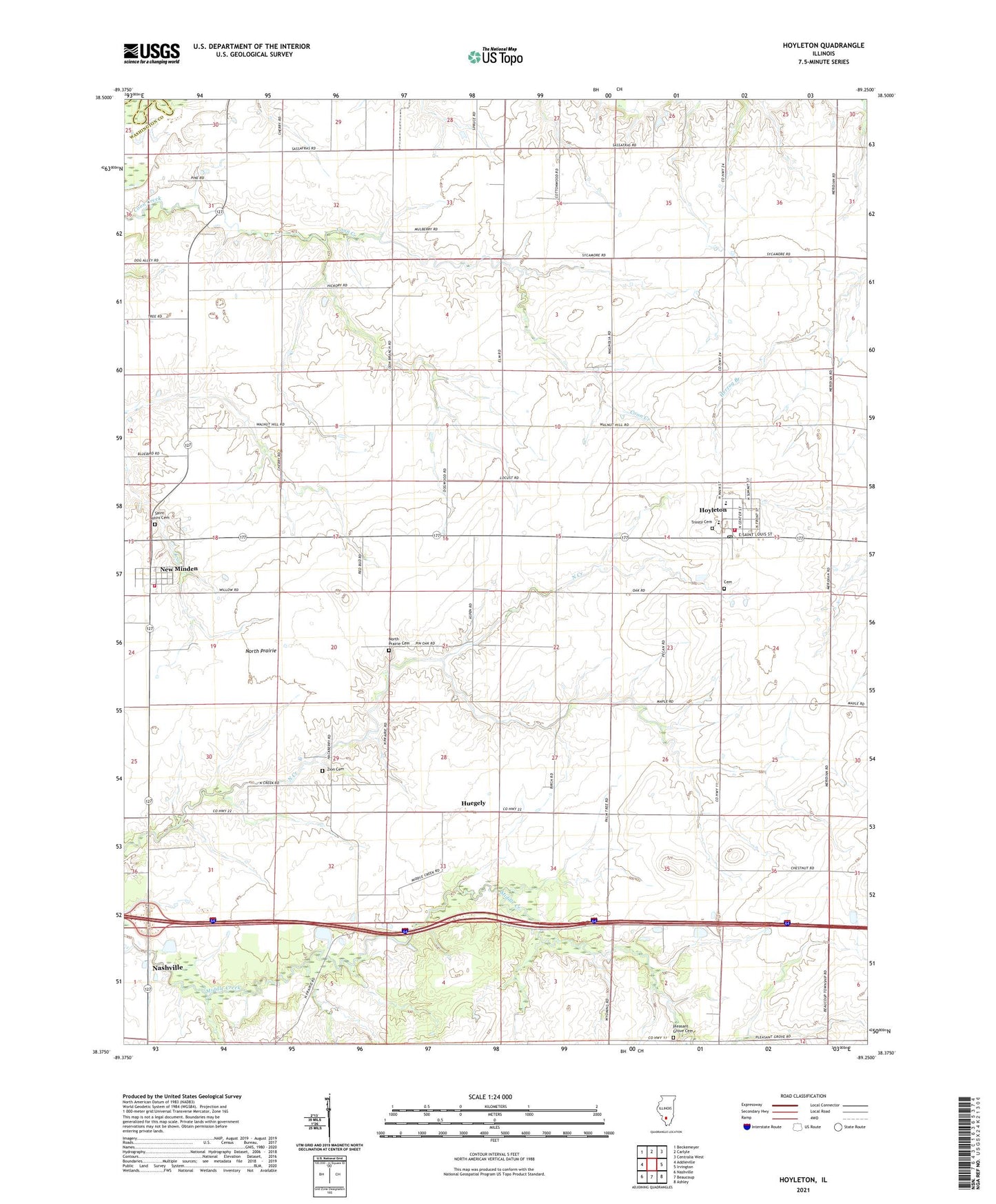
2024 topographic map quadrangle Hoyleton in the state of Illinois. Scale: 1:24000. Based on the newly updated USGS 7.5' US Topo map series, this map is in the following counties: Washington, Clinton. The map contains contour data, water features, and other items you are used to seeing on USGS maps, but also has updated roads and other features. This is the next generation of topographic maps. Printed on high-quality waterproof paper with UV fade-resistant inks.
Quads adjacent to this one:
West: Addieville
Northwest: Beckemeyer
North: Carlyle
Northeast: Centralia West
East: Irvington
Southeast: Ashley
South: Beaucoup
Southwest: Nashville
This map covers the same area as the classic USGS quad with code o38089d3.
Contains the following named places: Cemetery, Elm Point School, Haun School, Hoyleton, Hoyleton Community Fire Protection District New Minden Station, Hoyleton Consolidated Elementary School, Hoyleton Fire Protection District, Hoyleton Post Office, Huegely, New Minden, North Prairie, North Prairie Cemetery, North Prairie Church, Pleasant Grove Cemetery, Pleasant Grove School, Saint Johns Cemetery, Saint Johns School, Sassafras School, Township of Hoyleton, Trinity Cemetery, Trinity Lutheran Church, Trinity Lutheran School, Unverfehrt Stock Farm, Village of Hoyleton, Village of New Minden, Walnut School, Zion Cemetery, Zion Evangelical United Church, ZIP Code: 62803