MyTopo
Beaucoup Illinois US Topo Map
Couldn't load pickup availability
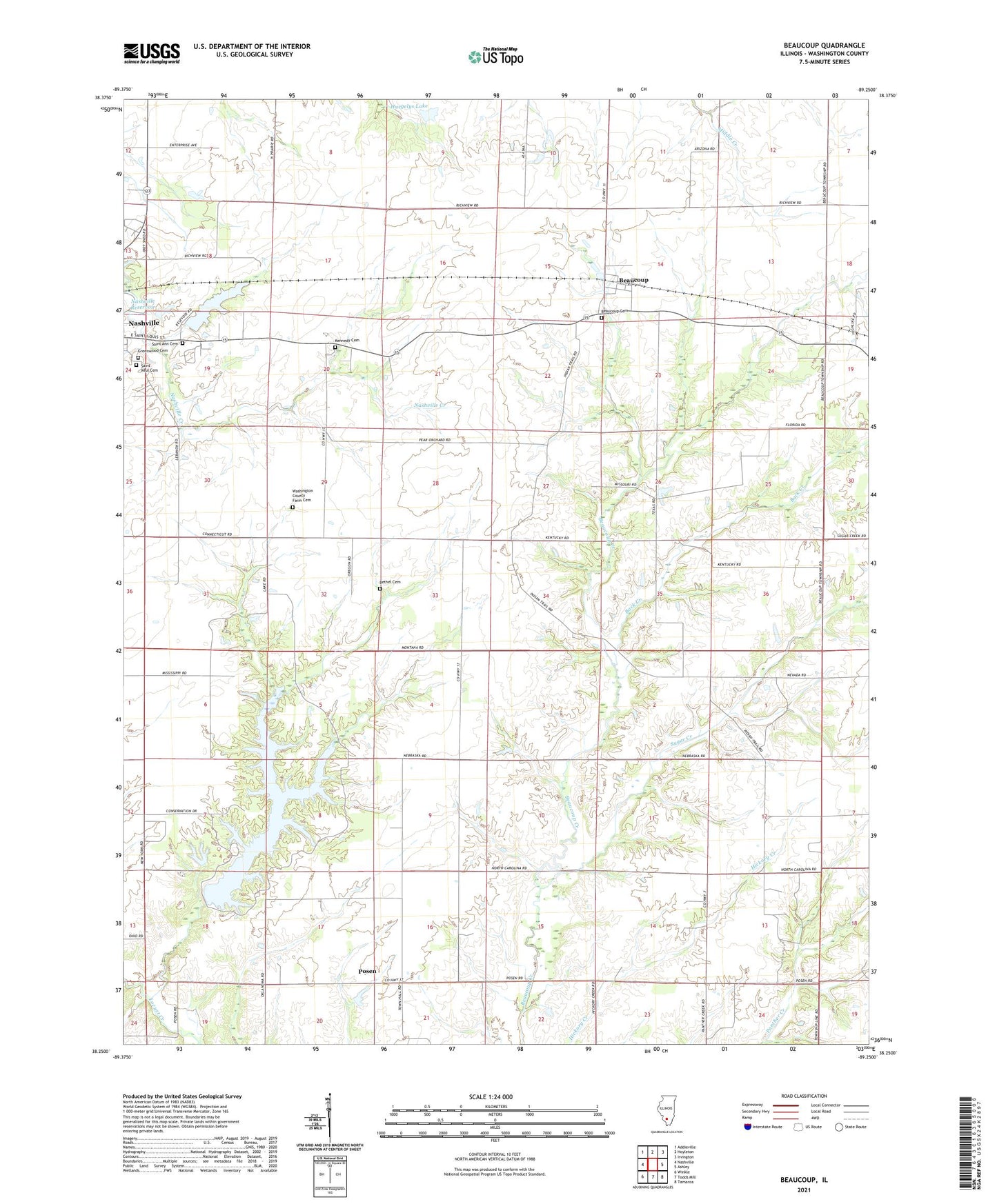
2024 topographic map quadrangle Beaucoup in the state of Illinois. Scale: 1:24000. Based on the newly updated USGS 7.5' US Topo map series, this map is in the following counties: Washington. The map contains contour data, water features, and other items you are used to seeing on USGS maps, but also has updated roads and other features. This is the next generation of topographic maps. Printed on high-quality waterproof paper with UV fade-resistant inks.
Quads adjacent to this one:
West: Nashville
Northwest: Addieville
North: Hoyleton
Northeast: Irvington
East: Ashley
Southeast: Tamaroa
South: Todds Mill
Southwest: Winkle
This map covers the same area as the classic USGS quad with code o38089c3.
Contains the following named places: Back Creek, Beaucoup, Beaucoup Cemetery, Beaucoup Oil Field, Becks Farm Landing Strip, Bethel Cemetery, Bethel School, Bolo School, Bolo Townhall, Greenwood Cemetery, Hickory Creek School, Huegelys Lake, Huegelys Lake Dam, Kennedy Cemetery, Lake View Picnic Area, Lazy L Picnic Area, Little Bear Camping Area, Lookout Point Picnic Area, Nashville City Reservoir, Nashville City Reservoir Dam, Nashville Reservoir, Nashville Reservoir Dam, Nashville Water Treatment Plant, Nuptial School, Oak Hill School, Ponderosa Picnic Area, Posen, Posen Woods Nature Preserve, Prairie Hill School, Saint Ann Cemetery, Saint Paul Cemetery, Sugar Creek, The Pines Picnic Area, Township of Beaucoup, Township of Bolo, Washington County Farm Cemetery, Washington County Lake, Washington County Lake Dam, Washington County State Conservation Area, WQHC-FM (Nashville)