MyTopo
Ava Illinois US Topo Map
Couldn't load pickup availability
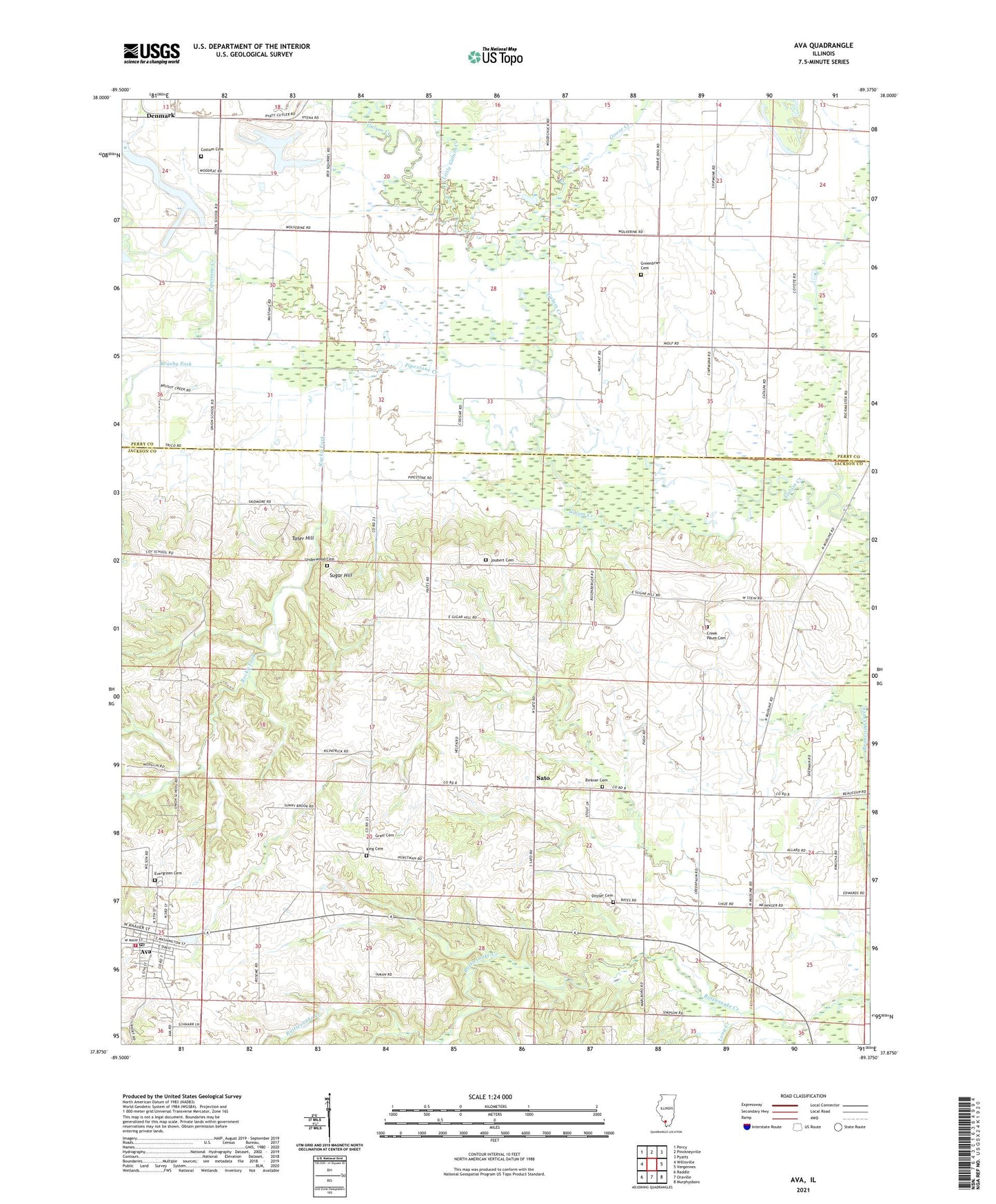
2024 topographic map quadrangle Ava in the state of Illinois. Scale: 1:24000. Based on the newly updated USGS 7.5' US Topo map series, this map is in the following counties: Jackson, Perry. The map contains contour data, water features, and other items you are used to seeing on USGS maps, but also has updated roads and other features. This is the next generation of topographic maps. Printed on high-quality waterproof paper with UV fade-resistant inks.
Quads adjacent to this one:
West: Willisville
Northwest: Percy
North: Pinckneyville
Northeast: Pyatts
East: Vergennes
Southeast: Murphysboro
South: Oraville
Southwest: Raddle
This map covers the same area as the classic USGS quad with code o37089h4.
Contains the following named places: Ava, Ava Post Office, Ava Volunteer Fire Department, Birkner Cemetery, Bower Park, Brushy Fork, Bryden, City of Ava, Cottom Cemetery, Creek Paum Cemetery, Denmark, Denmark Baptist Church, Ditzler Cemetery, Edwards School, Evergreen Cemetery, Goose Creek, Graff Cemetery, Greenbrier Cemetery, Jackson County Ambulance Service, Jenkins School, Joubert Cemetery, King Cemetery, Little Galum Creek, Long Creek, Ora Station, Pipestone Creek, Rocky Fork, Sato, Sugar Hill, Sugar Hill School, Tater Hill, Township of Ora, Underwood Cemetery, Union Community Center