MyTopo
Pyatts Illinois US Topo Map
Couldn't load pickup availability
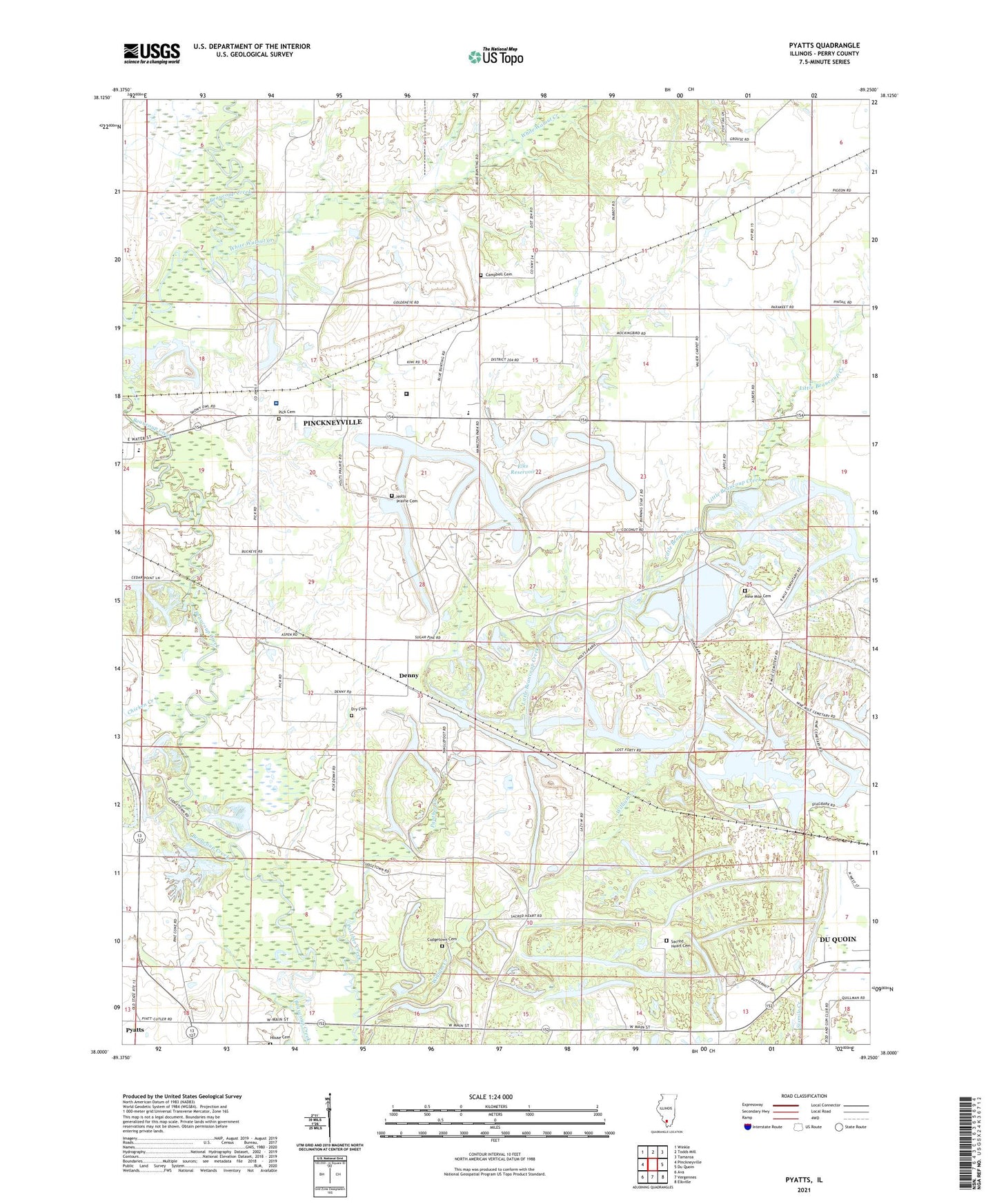
2024 topographic map quadrangle Pyatts in the state of Illinois. Scale: 1:24000. Based on the newly updated USGS 7.5' US Topo map series, this map is in the following counties: Perry. The map contains contour data, water features, and other items you are used to seeing on USGS maps, but also has updated roads and other features. This is the next generation of topographic maps. Printed on high-quality waterproof paper with UV fade-resistant inks.
Quads adjacent to this one:
West: Pinckneyville
Northwest: Winkle
North: Todds Mill
Northeast: Tamaroa
East: Du Quoin
Southeast: Elkville
South: Vergennes
Southwest: Ava
This map covers the same area as the classic USGS quad with code o38089a3.
Contains the following named places: Bethel Lutheran Church, Breeze Lake, Campbell Cemetery, Chicken Creek, Cudgetown Cemetery, Cudgetown School, Denny, Dry Cemetery, Du Quoin Number 5 Election Precinct, Du Quoin Number 9 Election Precinct, Elks Reservoir, Elks Reservoir Dam, Friendship Church, Fulk Heliport, Hickory Grove School, Holts Prairie Cemetery, Holts Prairie Church, House Cemetery, Illinois Central Reservoir, Jewel Mine Number 2, Little Beaucoup Creek, Lower Holts School, Marlow School, Nine Mile Baptist Church, Nine Mile Cemetery, Osborne School, Panther Mine, Perry County, Perry Ridge Landfill, Pick Cemetery, Pinckneyville Community Hospital, Pinckneyville Correctional Center, Pinckneyville Middle School, Pinckneyville Number 2 Election Precinct, Pinckneyville Number 6 Election Precinct, Pinckneyville Number 7 Election Precinct, Pyatts, Sacred Heart Cemetery, School Number 204, Shakerag School, Slawson School, Upper Arm School, Victory Coal Mine, White Walnut Creek, William Creek