MyTopo
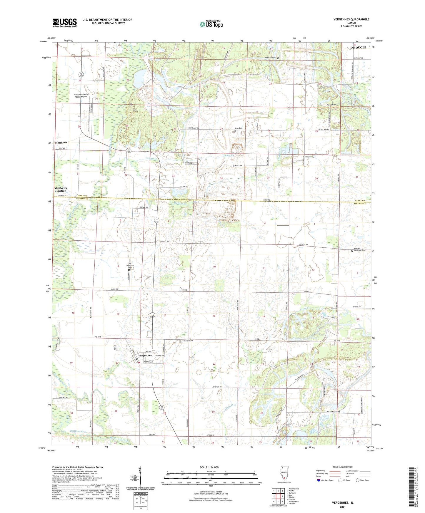
Vergennes Illinois US Topo Map
Couldn't load pickup availability
2024 topographic map quadrangle Vergennes in the state of Illinois. Scale: 1:24000. Based on the newly updated USGS 7.5' US Topo map series, this map is in the following counties: Jackson, Perry. The map contains contour data, water features, and other items you are used to seeing on USGS maps, but also has updated roads and other features. This is the next generation of topographic maps. Printed on high-quality waterproof paper with UV fade-resistant inks.
Quads adjacent to this one:
West: Ava
Northwest: Pinckneyville
North: Pyatts
Northeast: Du Quoin
East: Elkville
Southeast: De Soto
South: Murphysboro
Southwest: Oraville
This map covers the same area as the classic USGS quad with code o37089h3.
Contains the following named places: Bethel Church, Bottom School, Brooks School, Burroughs School, Cox Prairie School, Du Quoin Number 4 Election Precinct, Forest School, Galum Creek, Grubbs, Matthews, Matthews Junction, McElvain Cemetery, Oak Grove School, Old Vegennes Cemetery, Panther Creek, Parrish Cemetery, Pinckneyville-Du Quoin Airport, Rattlesnake Creek, Ross Cemetery, Russian Orthodox Cemetery, Sutter Cemetery, Sutter Church, Township of Vergennes, Vancil Cemetery, Vergennes, Vergennes Elementary School, Vergennes Fire Department, Vergennes Post Office, Village of Vergennes, Walker School, Walkers Creek, Woodward School, Youngs Creek, ZIP Code: 62994