MyTopo
Banner Illinois US Topo Map
Couldn't load pickup availability
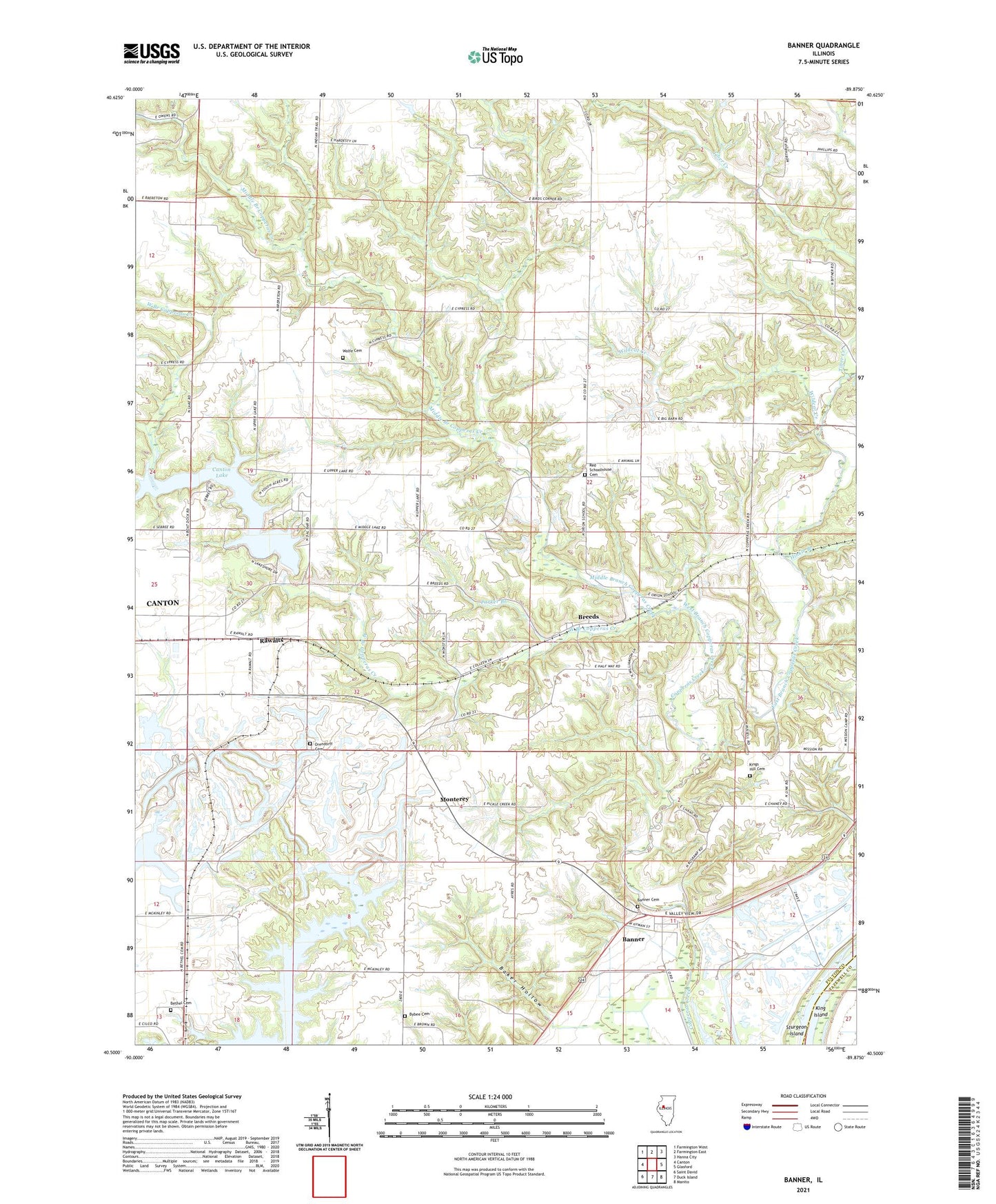
2024 topographic map quadrangle Banner in the state of Illinois. Scale: 1:24000. Based on the newly updated USGS 7.5' US Topo map series, this map is in the following counties: Fulton, Tazewell, Peoria. The map contains contour data, water features, and other items you are used to seeing on USGS maps, but also has updated roads and other features. This is the next generation of topographic maps. Printed on high-quality waterproof paper with UV fade-resistant inks.
Quads adjacent to this one:
West: Canton
Northwest: Farmington West
North: Farmington East
Northeast: Hanna City
East: Glasford
Southeast: Manito
South: Duck Island
Southwest: Saint David
This map covers the same area as the classic USGS quad with code o40089e8.
Contains the following named places: Baker Hollow, Banner, Banner Cemetery, Banner School, Baxter Mine, Bells Landing, Bethel Cemetery, Bethel Chapel, Birds Corners School, Breeds, Breeds Cemetery, Breeds School, Burhans School, Bybee Cemetery, Canton City Lake, Canton City Lake Dam, Canton Lake, Douglas School, Duffield School, East Branch Copperas Creek, Enterprise School, First Church of the Nazarene, Ford School, Franklin School, G and L Mine, Green Valley School, Hinkle Branch, King Hill School, King Island, Kings Hill Cemetery, Little Brick School, Middle Branch Copperas Creek, Monterey, Monterey School, Orendorff Cemetery, Orion School, Parker Branch, Rawalts, Red School, Red Schoolhouse Cemetery, Sandler Spur, Tiber Creek, Township of Orion, Village of Banner, WBOD-FM (Canton), West Branch Copperas Creek, White Chapel, Wildcat Creek, Wolf School, Wolfe Cemetery