MyTopo
Hanna City Illinois US Topo Map
Couldn't load pickup availability
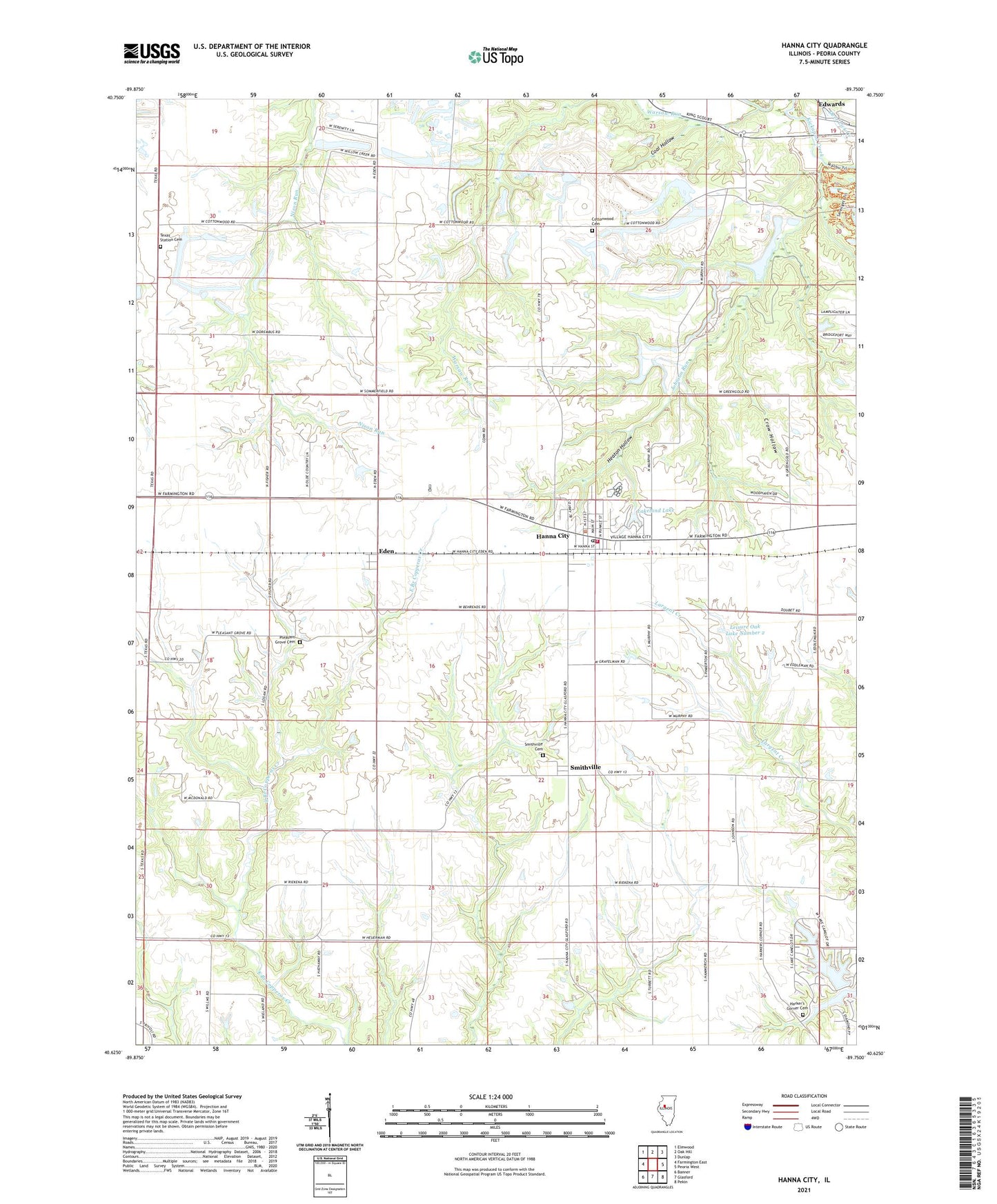
2024 topographic map quadrangle Hanna City in the state of Illinois. Scale: 1:24000. Based on the newly updated USGS 7.5' US Topo map series, this map is in the following counties: Peoria. The map contains contour data, water features, and other items you are used to seeing on USGS maps, but also has updated roads and other features. This is the next generation of topographic maps. Printed on high-quality waterproof paper with UV fade-resistant inks.
Quads adjacent to this one:
West: Farmington East
Northwest: Elmwood
North: Oak Hill
Northeast: Dunlap
East: Peoria West
Southeast: Pekin
South: Glasford
Southwest: Banner
This map covers the same area as the classic USGS quad with code o40089f7.
Contains the following named places: Cherry Fork School, Christ Orchard, Coal Hollow, Cottonwood Cemetery, Cottonwood Church, Cottonwood School, Crow Hollow, East Farmington School, Eden, Hanna City, Hanna City Air Force Station, Hanna City Boys School, Hanna City Elementary School, Hanna City Post Office, Harker's Corner Cemetery, Heaton Hollow, Johnson Run, Lake Camelot, Lake Camelot Census Designated Place, Lake Camelot Dam, Lakeland Lake, Lakeland Lake Dam, Leisure Oak Lake Number 2, Leisure Oak Lake Number 2 Dam, Logan - Trivoli Fire Protection District Hanna City Station, Morris School, Patton School, Peoria City - County Landfill, Pinkerton School, Pleasant Grove Cemetery, Pleasant Grove School, Salem School, Smithville, Smithville Cemetery, Smithville Census Designated Place, Texas Station Cemetery, Township of Logan, Union School, United Methodist Church, Village of Hanna City, Warsaw Run, ZIP Code: 61536