MyTopo
Manito Illinois US Topo Map
Couldn't load pickup availability
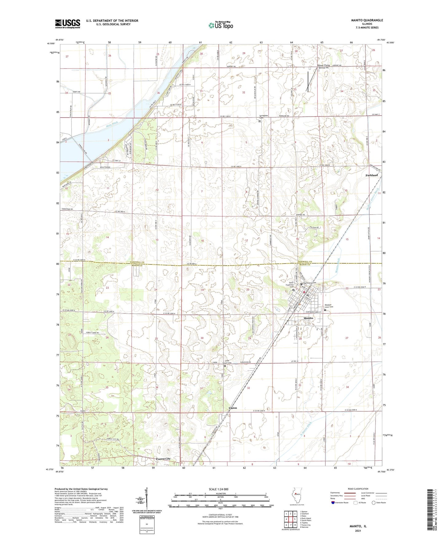
2024 topographic map quadrangle Manito in the state of Illinois. Scale: 1:24000. Based on the newly updated USGS 7.5' US Topo map series, this map is in the following counties: Mason, Tazewell. The map contains contour data, water features, and other items you are used to seeing on USGS maps, but also has updated roads and other features. This is the next generation of topographic maps. Printed on high-quality waterproof paper with UV fade-resistant inks.
Quads adjacent to this one:
West: Duck Island
Northwest: Banner
North: Glasford
Northeast: Pekin
East: South Pekin
Southeast: Natrona
South: Forest City
Southwest: Topeka
This map covers the same area as the classic USGS quad with code o40089d7.
Contains the following named places: Campground Number 1, Coon Grove Cemetery, County Line School, Crescent School, Dodds School, Forman Fire Protection District, Golden School, Main Ditch, Manito, Manito Ditch, Manito Post Office, Meadow Lawn Cemetery, Midwest Central High School, Midwest Central Primary School, North Park Picnic Area, North Quiver Ditch, Oak Grove Cemetery, Palmer Flying Service Inc, Parkland, Pine Campground, Radville, Saint Fredricks Cemetery, Sand Ridge State Forest, Sand Ridge State Forest Headquarters, Sewell Lake, Spring Garden School, Spring Lake, Spring Lake Church, Spring Lake State Park, Spring Lake Townhall, Springlake Cemetery, Star School, Township of Manito, Township of Spring Lake, Union, Union School, Village of Manito, Waddell Airport, ZIP Code: 61546