MyTopo
Bushnell East Illinois US Topo Map
Couldn't load pickup availability
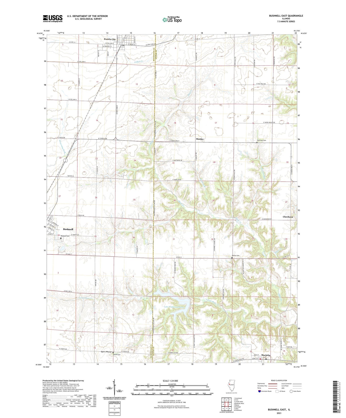
2024 topographic map quadrangle Bushnell East in the state of Illinois. Scale: 1:24000. Based on the newly updated USGS 7.5' US Topo map series, this map is in the following counties: Fulton, McDonough. The map contains contour data, water features, and other items you are used to seeing on USGS maps, but also has updated roads and other features. This is the next generation of topographic maps. Printed on high-quality waterproof paper with UV fade-resistant inks.
Quads adjacent to this one:
West: Bushnell West
Northwest: Greenbush
North: Avon
Northeast: London Mills
East: Blyton
Southeast: Smithfield
South: Adair
Southwest: Bardolph
This map covers the same area as the classic USGS quad with code o40090e4.
Contains the following named places: Barnes Cemetery, Barnes School, Brock School, Bushnell Cemetery, Checkrow, Checkrow Cemetery, Checkrow Community Church, Crowl School, Curtis School, Dyers Mound, First Baptist Church, Guernsey Cemetery, Harris School, Hawn School, Lake Wildwood Haven, Lake Wildwood Haven Dam, Lee School, Manley, Marietta, Marietta Fire Department, Marietta Post Office, Mound Cemetery, Mound School, Mound United Brethren in Christ Church, Oak Grove School, Peirsol Cemetery, Piersols Run, Pleasant Hill School, Prairie City, Prairie City Airport, Prairie City Community Church, Prairie City Fire Protection District, Prairie City High School, Prairie City Methodist Episcopal Church, Prairie City Park, Prairie City Post Office, Prairie City Presbyterian Church, Prairie Land Community Center, Prairieland Open Bible Center, Ramsey Branch, Silver Creek, South Fork Shaw Creek, Township of Lee, Village of Prairie City, Virgil, Virgil Methodist Episcopal Church, Virgil School, WSRQ-FM (Bushnell), ZIP Code: 61459