MyTopo
Beecher City Illinois US Topo Map
Couldn't load pickup availability
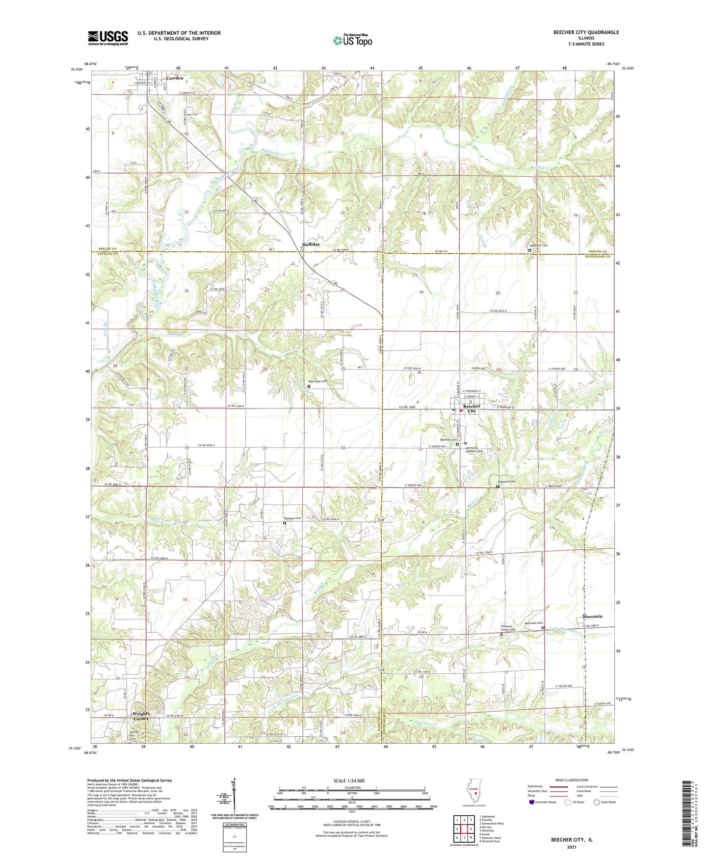
2024 topographic map quadrangle Beecher City in the state of Illinois. Scale: 1:24000. Based on the newly updated USGS 7.5' US Topo map series, this map is in the following counties: Fayette, Effingham, Shelby. The map contains contour data, water features, and other items you are used to seeing on USGS maps, but also has updated roads and other features. This is the next generation of topographic maps. Printed on high-quality waterproof paper with UV fade-resistant inks.
Quads adjacent to this one:
West: Herrick
Northwest: Lakewood
North: Fancher
Northeast: Stewardson West
East: Shumway
Southeast: Altamont East
South: Altamont West
Southwest: Avena
This map covers the same area as the classic USGS quad with code o39088b7.
Contains the following named places: Beecher Cemetery, Beecher City, Beecher City Grade School, Beecher City Junior-Senior High School, Beecher City Post Office, Bob Doan Cemetery, Brush Creek, Buzzard School, Carter Camp, Carter Refinery, Cary Branch, Corwin Branch, Cowden, Cowden Bridge, Cowden Elementary School, Cowden-Herrick High School, Fanny Branch, Gossage Branch, Greenland, Greenland Church, Greenland School, Holliday, Hubbartt Cemetery, Hubbartt Church, Logue School, Loudon Oil Field, Memorial Gardens Cemetery, Miller School, Moccasin, Moccasin Cemetery, Oakland School, Petty Branch, Pleasant Grove Cemetery, Pleasant Hill School, Prairie Union School, Ransom Cemetery, Ransom Church, Richland Creek, Tipsword Cemetery, Township of Dry Point, Tri - County Fire Station of Beecher City, Village of Beecher City, Village of Cowden, Wrights Corner, ZIP Code: 62414