MyTopo
Lakewood Illinois US Topo Map
Couldn't load pickup availability
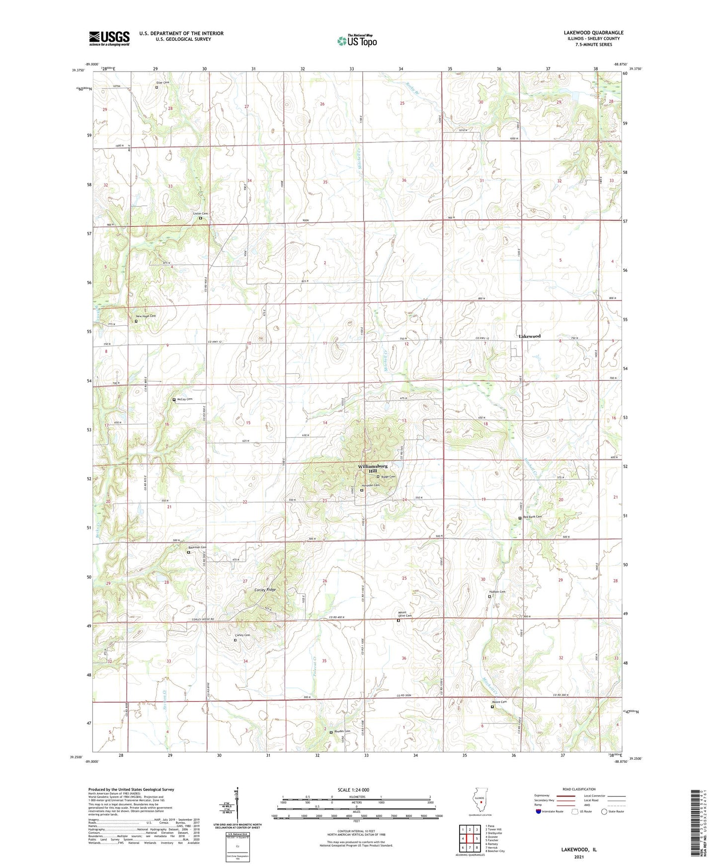
2024 topographic map quadrangle Lakewood in the state of Illinois. Scale: 1:24000. Based on the newly updated USGS 7.5' US Topo map series, this map is in the following counties: Shelby. The map contains contour data, water features, and other items you are used to seeing on USGS maps, but also has updated roads and other features. This is the next generation of topographic maps. Printed on high-quality waterproof paper with UV fade-resistant inks.
Quads adjacent to this one:
West: Oconee
Northwest: Pana
North: Tower Hill
Northeast: Shelbyville
East: Fancher
Southeast: Beecher City
South: Herrick
Southwest: Ramsey
This map covers the same area as the classic USGS quad with code o39088c8.
Contains the following named places: Bateman Cemetery, Center School, Champion School, Cold Spring Townhall, Corley Cemetery, Corley Ridge, Corley School, Eiler Cemetery, Greenleaf School, Horsman Cemetery, Hudson Cemetery, Lakewood, Lakewood Census Designated Place, Lakewood Post Office, Liston Cemetery, Lockwood School, McCoy Cemetery, Moore Cemetery, Mound Cemetery, Mount Olive Cemetery, New Hope Cemetery, Palestine School, Red Bank Cemetery, Rhodes Cemetery, Ridge Cemetery, Rocky Branch, Rocky Branch School, Standard School, Stark School, Summit School, Town House, Township of Cold Spring, West New Hope Church, Westminster, Williamsburg, Williamsburg Hill, Zion Church