MyTopo
Herrick Illinois US Topo Map
Couldn't load pickup availability
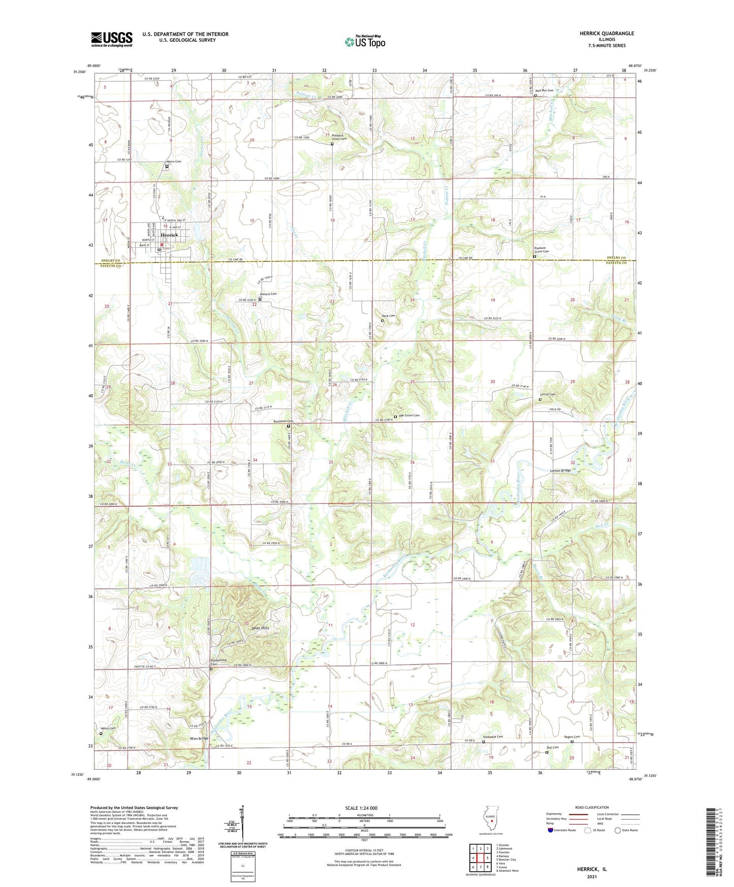
2024 topographic map quadrangle Herrick in the state of Illinois. Scale: 1:24000. Based on the newly updated USGS 7.5' US Topo map series, this map is in the following counties: Fayette, Shelby. The map contains contour data, water features, and other items you are used to seeing on USGS maps, but also has updated roads and other features. This is the next generation of topographic maps. Printed on high-quality waterproof paper with UV fade-resistant inks.
Quads adjacent to this one:
West: Ramsey
Northwest: Oconee
North: Lakewood
Northeast: Fancher
East: Beecher City
Southeast: Altamont West
South: Avena
Southwest: Vera
This map covers the same area as the classic USGS quad with code o39088b8.
Contains the following named places: Antioch Cemetery, Bacon Branch, Beck Cemetery, Becks Creek, Blankenship Cemetery, Bowling Green Townhall, Buchanan Cemetery, Dean Hills, Dean Hills Nature Preserve, Dial Cemetery, Good Hope School, Herrick, Herrick Elementary School, Herrick Fire Department, Herrick Post Office, Hog Creek, Hog Creek School, Kaskaskia Cemetery, Kaskaskia Church, Liberty School, Lorton Bridge, Lorton Cemetery, Lorton Church, Mitchell Creek, Mud Run Cemetery, Mud Run School, Myers Cemetery, Oak Grove Cemetery, Oak Grove Church, Pint Creek, Pleasant Grove Cemetery, Pleasant Grove School, Pleasant Union Cemetery, Pleasant Union School, Polecat Creek, Rogers Cemetery, School Number 10, Section Creek, Shady Lane School, Township of Bowling Green, Township of Carson, Township of Herrick, Township of Loudon, Valley School, Victory School, Village of Herrick, Welch Cemetery, Wren Bridge, ZIP Codes: 62422, 62431