MyTopo
Shumway Illinois US Topo Map
Couldn't load pickup availability
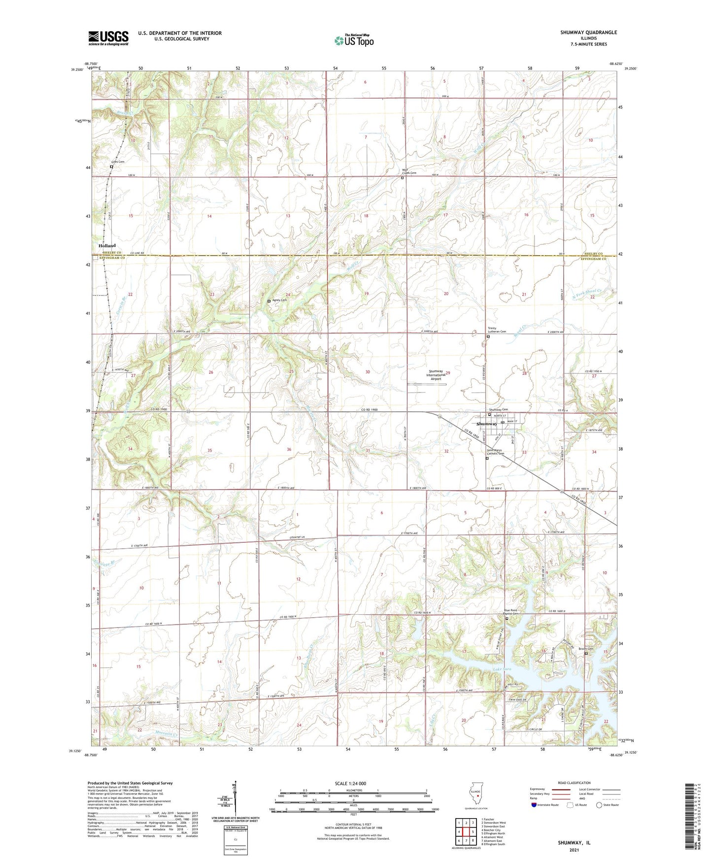
2024 topographic map quadrangle Shumway in the state of Illinois. Scale: 1:24000. Based on the newly updated USGS 7.5' US Topo map series, this map is in the following counties: Effingham, Shelby. The map contains contour data, water features, and other items you are used to seeing on USGS maps, but also has updated roads and other features. This is the next generation of topographic maps. Printed on high-quality waterproof paper with UV fade-resistant inks.
Quads adjacent to this one:
West: Beecher City
Northwest: Fancher
North: Stewardson West
Northeast: Stewardson East
East: Effingham North
Southeast: Effingham South
South: Altamont East
Southwest: Altamont West
This map covers the same area as the classic USGS quad with code o39088b6.
Contains the following named places: Agney Cemetery, Blue Point Baptist Cemetery, Blue Point School, Brown Cemetery, Brush Creek Post Office, Giles Cemetery, Holland, Kyle School, Lake Sara, Laue Farms, Morris Creek, Saint Marys Catholic Cemetery, Shumway, Shumway Cemetery, Shumway Grade School, Shumway International Airport, Shumway Post Office, Township of Banner, Township of Holland, Township of Liberty, Township of Moccasin, Township of Summit, Trinity Lutheran Cemetery, Van Treese Church, Village of Shumway, Wachtel Farms, Wendte Farms, White Chapel, Wolf Creek Cemetery, ZIP Code: 62461