MyTopo
Berwick Illinois US Topo Map
Couldn't load pickup availability
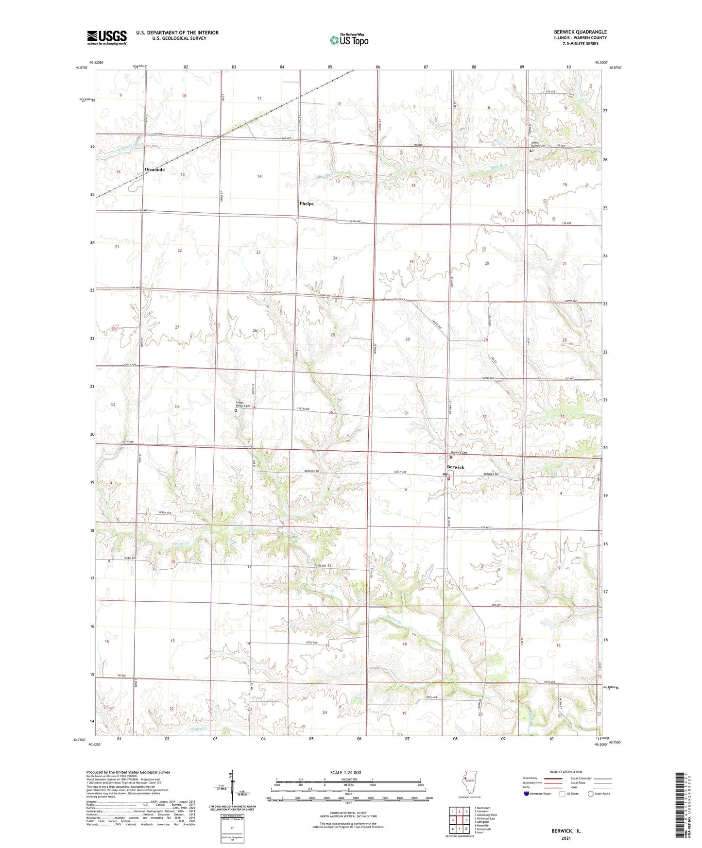
2024 topographic map quadrangle Berwick in the state of Illinois. Scale: 1:24000. Based on the newly updated USGS 7.5' US Topo map series, this map is in the following counties: Warren. The map contains contour data, water features, and other items you are used to seeing on USGS maps, but also has updated roads and other features. This is the next generation of topographic maps. Printed on high-quality waterproof paper with UV fade-resistant inks.
Quads adjacent to this one:
West: Kirkwood East
Northwest: Monmouth
North: Cameron
Northeast: Galesburg West
East: Abingdon
Southeast: Avon
South: Greenbush
Southwest: Roseville
This map covers the same area as the classic USGS quad with code o40090g5.
Contains the following named places: Abingdon Fire Protection District Station 2, Berwick, Berwick Cemetery, Berwick Post Office, Carr School, Center School, Central School, Fairview Center Church, Lenox Union Cemetery, Massasauga Prairie Nature Preserve, Means School, Mud Corners School, Ormonde, Phelps, Pleasant Hill School, Richey School, Shortsville School, Silent Home Cemetery, Township of Berwick, Township of Lenox, Township of Roseville, Union School, Warren County, West Prairie School, Windy Ridge School, Youngquist Lake, Youngquist Lake Dam, ZIP Code: 61417