MyTopo
Greenbush Illinois US Topo Map
Couldn't load pickup availability
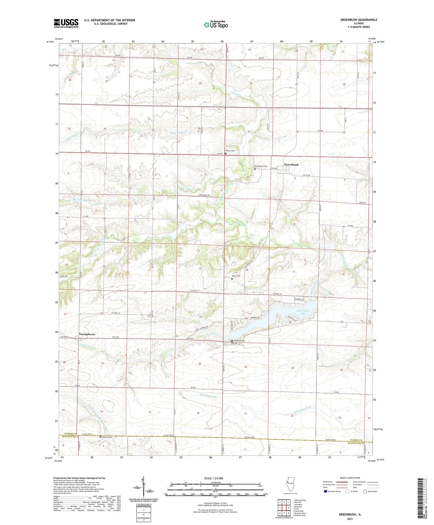
2024 topographic map quadrangle Greenbush in the state of Illinois. Scale: 1:24000. Based on the newly updated USGS 7.5' US Topo map series, this map is in the following counties: Warren, McDonough. The map contains contour data, water features, and other items you are used to seeing on USGS maps, but also has updated roads and other features. This is the next generation of topographic maps. Printed on high-quality waterproof paper with UV fade-resistant inks.
Quads adjacent to this one:
West: Roseville
Northwest: Kirkwood East
North: Berwick
Northeast: Abingdon
East: Avon
Southeast: Bushnell East
South: Bushnell West
Southwest: Good Hope
This map covers the same area as the classic USGS quad with code o40090f5.
Contains the following named places: Big Negro Creek, Bond Cemetery, Crawford School, Downing School, Greenbush, Greenbush Cemetery, Greenbush Townhall, Halls School, Hoisington School, Larkins Cemetery, Little Negro Creek, Little Swan Creek, Little Swan Lake, Little Swan Lake Dam, McMahill Cemetery, Miller School, Negro Creek, Pierce Cemetery, Pleasant Mound Methodist Episcopal Church, Simmons School, Star School, Sugarloaf School, Swan Hills Country Club, Taft School, Taylor School, Township of Greenbush, Township of Swan, Youngstown