MyTopo
Abingdon Illinois US Topo Map
Couldn't load pickup availability
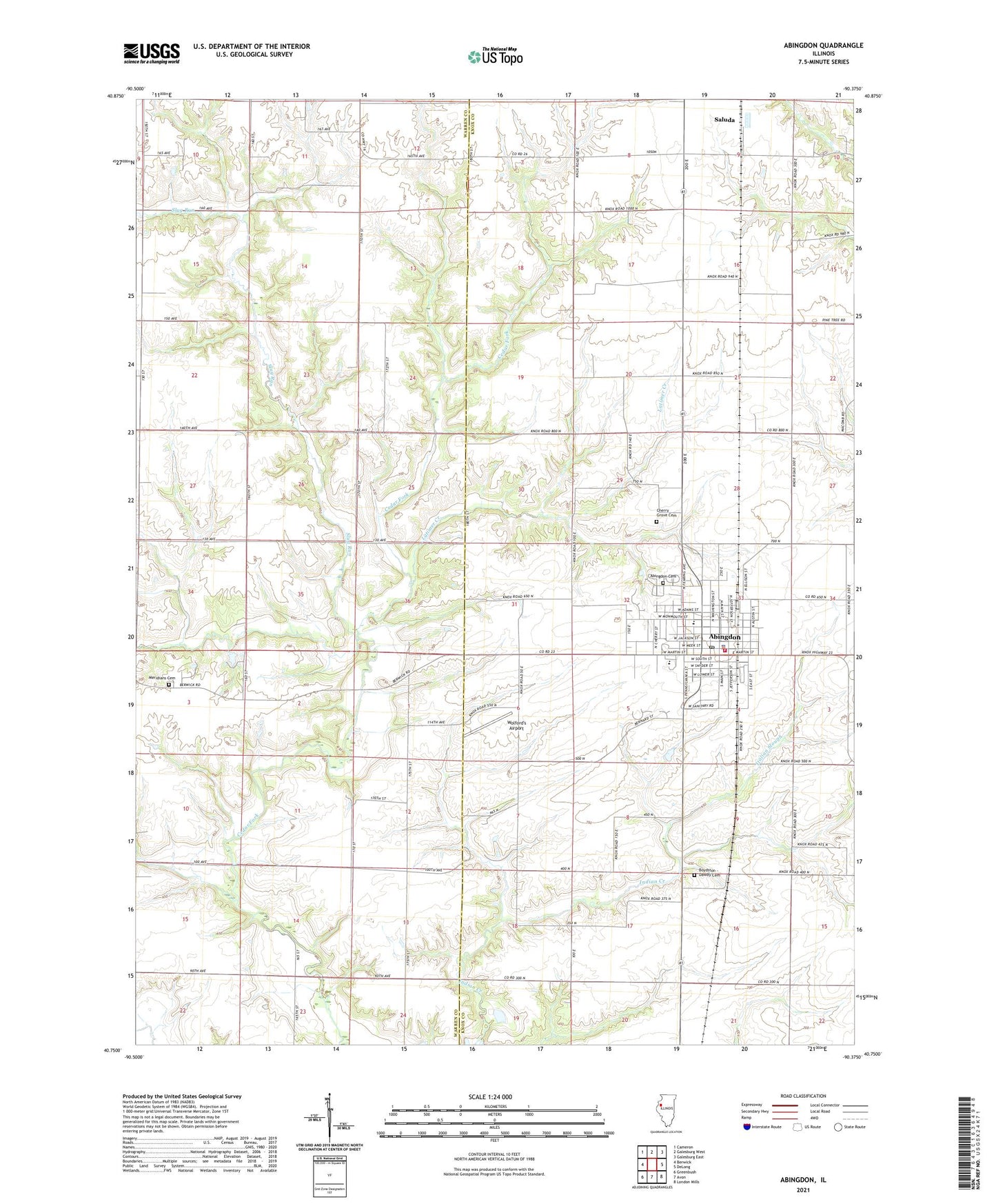
2024 topographic map quadrangle Abingdon in the state of Illinois. Scale: 1:24000. Based on the newly updated USGS 7.5' US Topo map series, this map is in the following counties: Knox, Warren. The map contains contour data, water features, and other items you are used to seeing on USGS maps, but also has updated roads and other features. This is the next generation of topographic maps. Printed on high-quality waterproof paper with UV fade-resistant inks.
Quads adjacent to this one:
West: Berwick
Northwest: Cameron
North: Galesburg West
Northeast: Galesburg East
East: DeLong
Southeast: London Mills
South: Avon
Southwest: Greenbush
This map covers the same area as the classic USGS quad with code o40090g4.
Contains the following named places: Abingdon, Abingdon Cemetery, Abingdon City Hall, Abingdon Fire Protection District Station 1, Abingdon High School, Abingdon Junior High School, Abingdon Police Department, Abingdon Post Office, Abingdon Water Works, All Souls Roman Catholic Church, Boydston - Dawdy Cemetery, Cherry Farm School, Cherry Grove Cemetery, Cherry Grove School, City of Abingdon, Cross Lane School, First Christian Church, First Church of the Nazarene, First Congregational Church, First Methodist Church, Hedding Grade School, Heller School, Indian Point School, Italian Slough, John Mosser Public Library, Kenan School, Latimer Creek, Legion Park, Lincoln Public School, Louisville School, Malone Landing Strip, Meridians Cemetery, Pretty Prairie School, Sacred Hearth Catholic Church, Saluda, Slug Run, Stringtown School, Township of Cedar, Township of Floyd, Township of Indian Point, Warren School, Washington Public School, Wolford's Airport, ZIP Code: 61410