MyTopo
Cameron Illinois US Topo Map
Couldn't load pickup availability
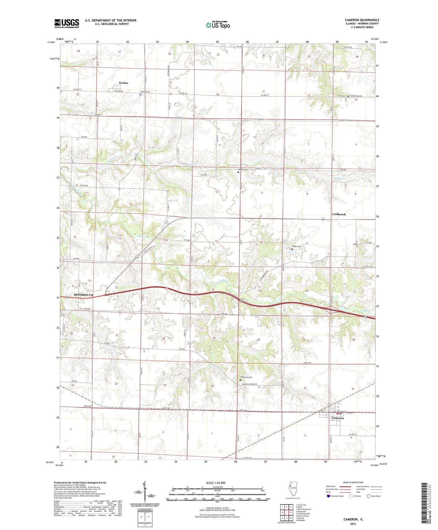
2024 topographic map quadrangle Cameron in the state of Illinois. Scale: 1:24000. Based on the newly updated USGS 7.5' US Topo map series, this map is in the following counties: Warren. The map contains contour data, water features, and other items you are used to seeing on USGS maps, but also has updated roads and other features. This is the next generation of topographic maps. Printed on high-quality waterproof paper with UV fade-resistant inks.
Quads adjacent to this one:
West: Monmouth
Northwest: Little York
North: Alexis
Northeast: North Henderson
East: Galesburg West
Southeast: Abingdon
South: Berwick
Southwest: Kirkwood East
This map covers the same area as the classic USGS quad with code o40090h5.
Contains the following named places: Cameron, Cameron Census Designated Place, Cameron Post Office, Central Warren Fire Department - Cameron Station, Chapman School, Coldbrook, Coldbrook School, Frymire School, Gerlaw, Gerlaw Cemetery, Gerlaw Post Office, Gibson Woods Golf Course, Grier School, Hawkins Farms Landing Strip, Hazeldell School, Hickory College, Hillis School, Lucas School, Mosher Cemetery, Ogden Cemetery, Patterson Cemetery, Science Hall School, Scotchtown School, Terpening Cemetery, Township of Monmouth, Warren School, Washington School, WMOI-FM (Monmouth), WRAM-AM (Monmouth), Youngs Landing Strip, ZIP Codes: 61423, 61435