MyTopo
Big Rock Illinois US Topo Map
Couldn't load pickup availability
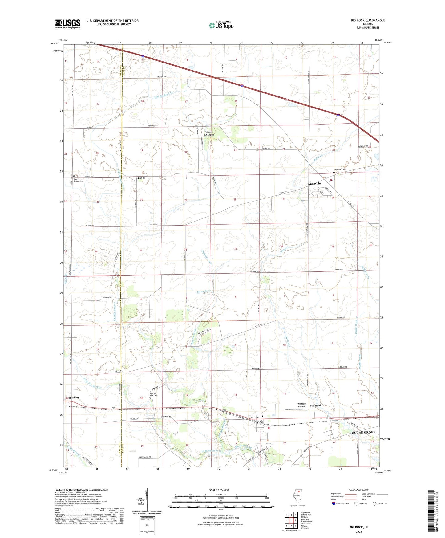
2024 topographic map quadrangle Big Rock in the state of Illinois. Scale: 1:24000. Based on the newly updated USGS 7.5' US Topo map series, this map is in the following counties: Kane, DeKalb. The map contains contour data, water features, and other items you are used to seeing on USGS maps, but also has updated roads and other features. This is the next generation of topographic maps. Printed on high-quality waterproof paper with UV fade-resistant inks.
Quads adjacent to this one:
West: Hinckley
Northwest: Sycamore
North: Maple Park
Northeast: Elburn
East: Sugar Grove
Southeast: Yorkville
South: Plano
Southwest: Somonauk
This map covers the same area as the classic USGS quad with code o41088g5.
Contains the following named places: Bell School, Big Rock, Big Rock Elementary School, Big Rock Fire Protection District, Big Rock Post Office, Duffin Drain West, East Branch Big Rock Creek, East Pierce Cemetery, English Congregational United Church, Evans School, Excelsior School, First Baptist Church, J Maddock Airport, Kaneville, Kaneville Cemetery, Kaneville Fire Protection District, Kaneville Post Office, Kaneville United Methodist Church, Lone Grove School, Long Grove Forest Preserve, Malgren Drain, Oakfield RLA Airport, Pierce Community Church, Plowmens Park, Swan Drain, Township of Big Rock, Township of Kaneville, Troxel, Village of Big Rock, Village of Kaneville, West Big Rock Cemetery, West Branch Big Rock Creek, White School, ZIP Codes: 60144, 60511