MyTopo
Plano Illinois US Topo Map
Couldn't load pickup availability
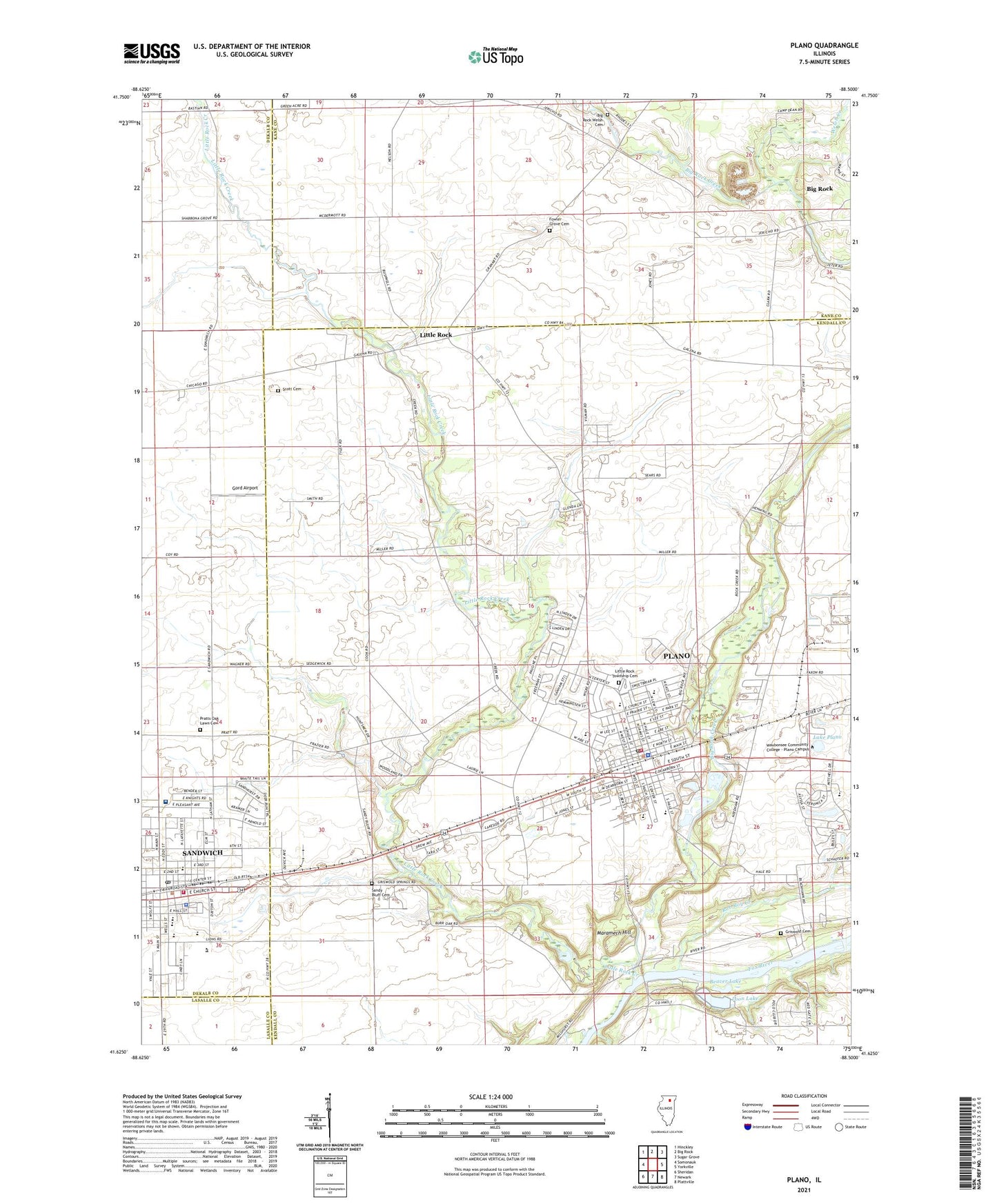
2024 topographic map quadrangle Plano in the state of Illinois. Scale: 1:24000. Based on the newly updated USGS 7.5' US Topo map series, this map is in the following counties: Kendall, Kane, DeKalb, LaSalle. The map contains contour data, water features, and other items you are used to seeing on USGS maps, but also has updated roads and other features. This is the next generation of topographic maps. Printed on high-quality waterproof paper with UV fade-resistant inks.
Quads adjacent to this one:
West: Somonauk
Northwest: Hinckley
North: Big Rock
Northeast: Sugar Grove
East: Yorkville
Southeast: Plattville
South: Newark
Southwest: Sheridan
This map covers the same area as the classic USGS quad with code o41088f5.
Contains the following named places: Beaver Dam Hiking and Cross-Country Ski Trail, Beaver Lake, Bible Church, Big Rock Creek, Big Rock Welsh Cemetery, Bluff Creek Farm, Brentwood Farm, Camp Dean, Cedar Ridge Primitive Campground, Centennial Elementary School, City of Plano, City of Sandwich, Coy School, Dummer Attendence Center, Foli Park, Fowler Grove Cemetery, Fox Ridge Nature Trail, Fox View Picnic Area, Gord Airport, Griswold Cemetery, Heddleson School, Hospital Heliport, Indian Valley Vocational Center, Klatt Field, Knights Park, Lake Plano, Little Rock, Little Rock Creek, Little Rock Fox Fire Department Station 1 Plano, Little Rock Township Cemetery, Loon Lake, Lynn G Haskin Elementary School, Maramach Forest Preserve, Maramech Hill, Maramech Woods Nature Preserve, Northside Baptist Church, Northwestern Medicine Valley West Hospital, P H Miller Elementary School, Plano, Plano Christian Church, Plano High School, Plano Middle School, Plano Police Department, Plano Post Office, Prairie View Equestrian Trail, Pratts Oak Lawn Cemetery, Reorganized Church of Jesus Christ of Latter Day Saints, Rob Roy Creek, Rockville School, Saint Marys School, Sandwich, Sandwich City Hall, Sandwich Community Fire Protection District, Sandwich High School, Sandwich Police Department, Sandwich Post Office, Sandwich Township Public Library, Sandy Bluff Cemetery, Sandy Bluff School, Scott Cemetery, Sears School, Silver Springs State Park, Tall Oaks Picnic Area, Township of Little Rock, Updike Landing Strip, W W Woodbury Elementary School, Welch Creek, Wiley Updike Airport, WSPY-FM (Plano), ZIP Code: 60545